MyTopo
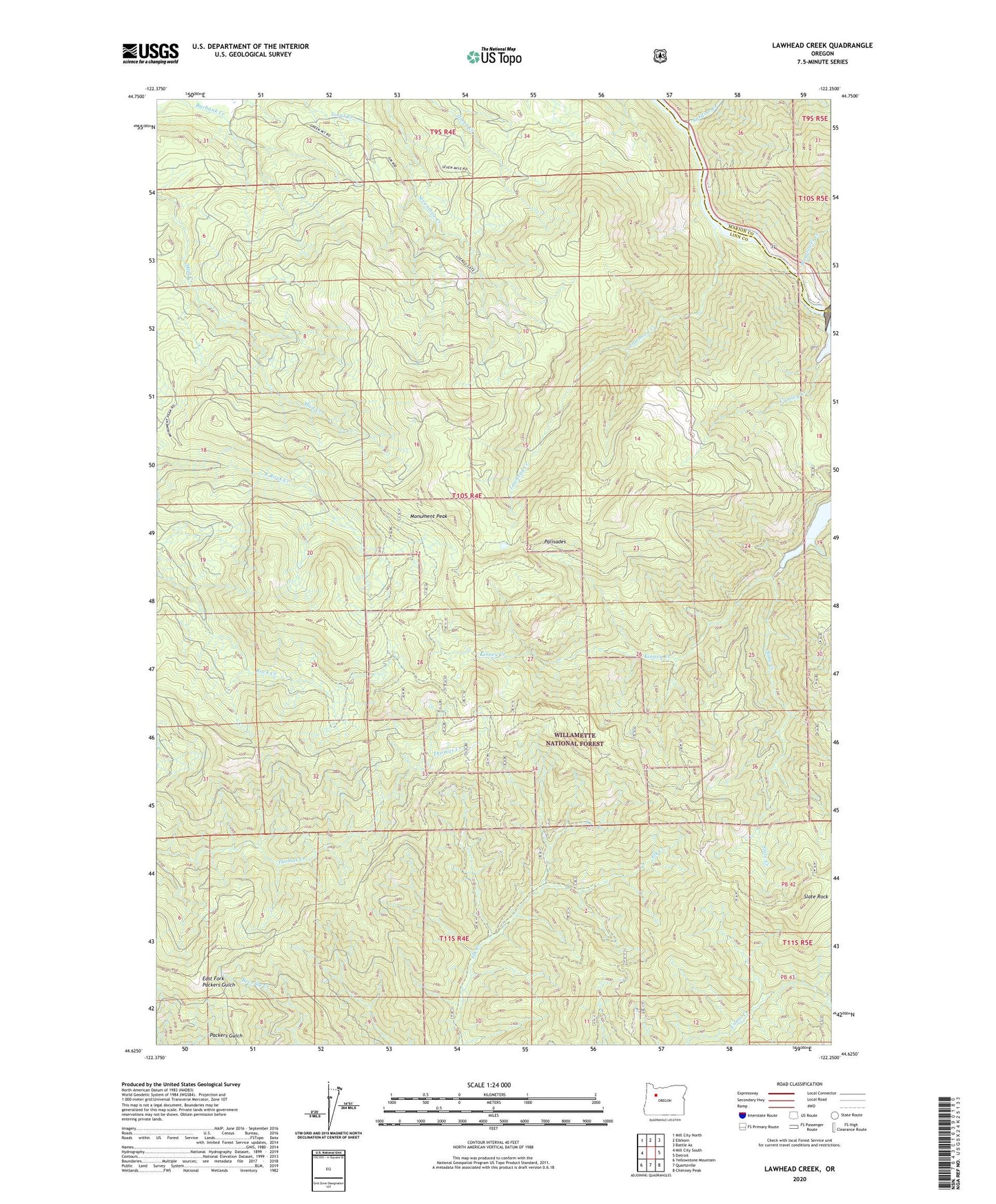
Lawhead Creek Oregon US Topo Map
Couldn't load pickup availability
Also explore the Lawhead Creek Forest Service Topo of this same quad for updated USFS data
2024 topographic map quadrangle Lawhead Creek in the state of Oregon. Scale: 1:24000. Based on the newly updated USGS 7.5' US Topo map series, this map is in the following counties: Linn, Marion. The map contains contour data, water features, and other items you are used to seeing on USGS maps, but also has updated roads and other features. This is the next generation of topographic maps. Printed on high-quality waterproof paper with UV fade-resistant inks.
Quads adjacent to this one:
West: Mill City South
Northwest: Mill City North
North: Elkhorn
Northeast: Battle Ax
East: Detroit
Southeast: Chimney Peak
South: Quartzville
Southwest: Yellowstone Mountain
This map covers the same area as the classic USGS quad with code o44122f3.
Contains the following named places: Big Cliff Reservoir, Cold Creek, Cumley Creek, Detroit Dam Road Boat Ramp, Gooch Lumber Company, Granite Mountain, Kinney Creek, Lawhead Creek, M and M Creek, Mayflower Creek, Monument Peak, Palisades, Rachel Post Office, Sardine Creek, Slate Creek, Slate Rock