MyTopo
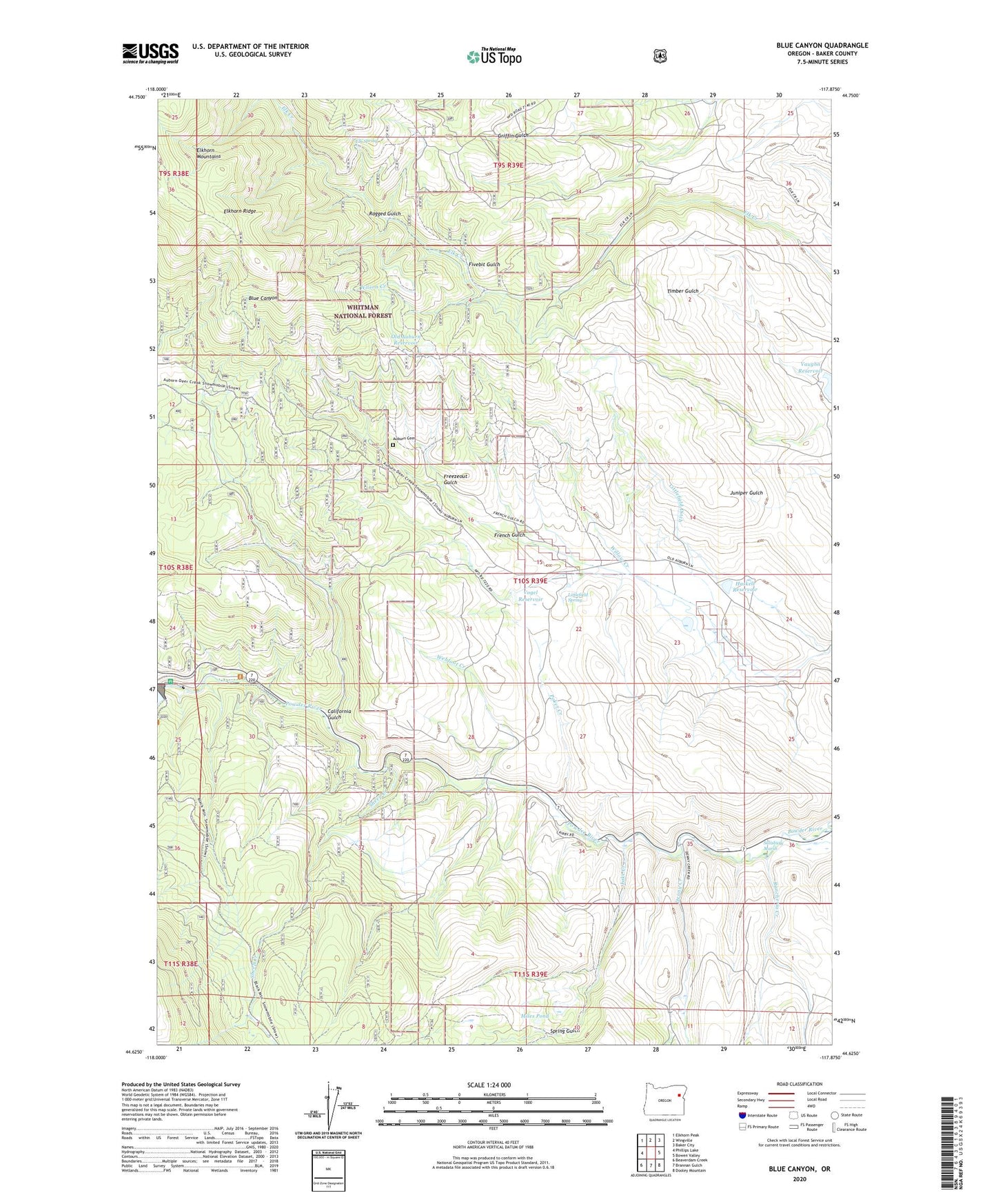
Blue Canyon Oregon US Topo Map
Couldn't load pickup availability
Also explore the Blue Canyon Forest Service Topo of this same quad for updated USFS data
2023 topographic map quadrangle Blue Canyon in the state of Oregon. Scale: 1:24000. Based on the newly updated USGS 7.5' US Topo map series, this map is in the following counties: Baker. The map contains contour data, water features, and other items you are used to seeing on USGS maps, but also has updated roads and other features. This is the next generation of topographic maps. Printed on high-quality waterproof paper with UV fade-resistant inks.
Quads adjacent to this one:
West: Phillips Lake
Northwest: Elkhorn Peak
North: Wingville
Northeast: Baker City
East: Bowen Valley
Southeast: Dooley Mountain
South: Brannan Gulch
Southwest: Beaverdam Creek
This map covers the same area as the classic USGS quad with code o44117f8.
Contains the following named places: Auburn, Auburn Cemetery, Auburn Post Office, Auburn Sno-Park, Boulder Gorge, California Gulch, Denny, Denny Creek, Elk Creek Settling Tank, Elk Spring, Fivebit Gulch, Freezeout Gulch, French Gulch, Haskell Reservoir, Lake Creek, Littlefield Ditch, Littlefield Spring, Lockhart, Malloy Cabin, Mason, Mason Dam, Mason Dam Recreation Site, Miles Pond, Old Auburn Reservoir, Poker Creek, Powder River Recreation Site, Ragged Gulch, Rancheria Creek, Salisbury Marsh, Sheep Creek, Spring Gulch, Thompson, Vaughn Reservoir, Vogel Reservoir, Webfoot Creek, Willow Creek, Wilson Creek