MyTopo
Phillips Lake Oregon US Topo Map
Couldn't load pickup availability
Also explore the Phillips Lake Forest Service Topo of this same quad for updated USFS data
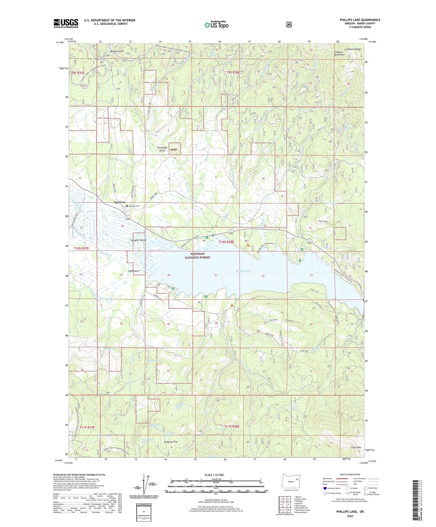
2024 topographic map quadrangle Phillips Lake in the state of Oregon. Scale: 1:24000. Based on the newly updated USGS 7.5' US Topo map series, this map is in the following counties: Baker. The map contains contour data, water features, and other items you are used to seeing on USGS maps, but also has updated roads and other features. This is the next generation of topographic maps. Printed on high-quality waterproof paper with UV fade-resistant inks.
Quads adjacent to this one:
West: Sumpter
Northwest: Bourne
North: Elkhorn Peak
Northeast: Wingville
East: Blue Canyon
Southeast: Brannan Gulch
South: Beaverdam Creek
Southwest: Unity Reservoir
This map covers the same area as the classic USGS quad with code o44118f1.
Contains the following named places: Adams Spring, Alder Creek, Alder Loop Spring, Baboon Creek, Birch Creek, Black Mountain, Bridge Creek, Britten Post Office, Camp Spring, Clear Creek, Cook Gulch, Curry, Dean Creek, Deer Creek, Deer Creek Recreation Site, East Fork Alder Creek, East Fork Birch Creek, East Fork Miners Creek, Farmers Ditch, Hershal Post Office, Hudspeth Guard Station, Jack Wilson Spring, Jeep Ride Spring, Lake Creek, Little Dean Creek, Log Cabin Spring, Mason Boat Ramp, McEwen, McEwen Cemetery, McEwen Post Office, McHenry Flat, McHenry Spring, Miller Lane Recreation Site, Miners Creek, Minersville, Moody Spring, Mowich Recreation Site, Phillips Lake, Picnic Spring, Pothole Spring, Rockne Gulch, Smith Creek, Southeast Shore Recreation Site, Southwest Shore Phillips Reservoir Boat Launch, Southwest Shore Recreation Site, Stovepipe Gulch, Sumpter Valley, Sumpter Valley Railway - McEwen Station, Tibbs Creek, Tope Spring, Union Creek, Union Creek Boat Ramp, Union Creek Recreation Site, West Fork Birch Creek