MyTopo
Elkhorn Peak Oregon US Topo Map
Couldn't load pickup availability
Also explore the Elkhorn Peak Forest Service Topo of this same quad for updated USFS data
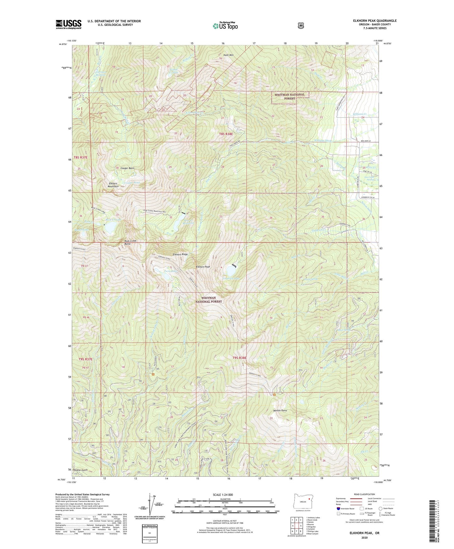
2024 topographic map quadrangle Elkhorn Peak in the state of Oregon. Scale: 1:24000. Based on the newly updated USGS 7.5' US Topo map series, this map is in the following counties: Baker. The map contains contour data, water features, and other items you are used to seeing on USGS maps, but also has updated roads and other features. This is the next generation of topographic maps. Printed on high-quality waterproof paper with UV fade-resistant inks.
Quads adjacent to this one:
West: Bourne
Northwest: Anthony Lakes
North: Rock Creek
Northeast: Haines
East: Wingville
Southeast: Blue Canyon
South: Phillips Lake
Southwest: Sumpter
This map covers the same area as the classic USGS quad with code o44118g1.
Contains the following named places: Bear Creek, Bucket Lake, Camp Lee, Cougar Basin, Cougar Pond, Coyote Spring, Crevice Creek, Eilertson Meadow, Elkhorn Crest Trail, Elkhorn Peak, Elkhorn Ridge, Excuse Mine, Gee Creek, Gee Creek Swamp, Goodrich Dam, Goodrich Lake, Hawk Spring, Highland Mine, Highland Trail, Hunt Mountain, Little Marble Creek, Little Mill Creek, Lower Baisley-Elkhorn Mine, Marble Creek Recreation Site, Marble Point, Maxwell Mine, Middle Camp Baisley-Elkhorn Mine, Nelson Ditch, North Fork Pine Creek, Pine Creek Dam, Pine Creek Reservoir, Rock Creek Butte, Rock Creek Lake, Rock Lake Dam, South Fork Rock Creek, South Prong Pine Creek, Tracy Post Office, Twin Lakes, Twin Lakes Trail, Upper Baisley-Elkhorn Mine, West Fork Lake Creek, Williams Ditch, Willow Creek Lake