MyTopo
Blue Mountain Pass Oregon US Topo Map
Couldn't load pickup availability
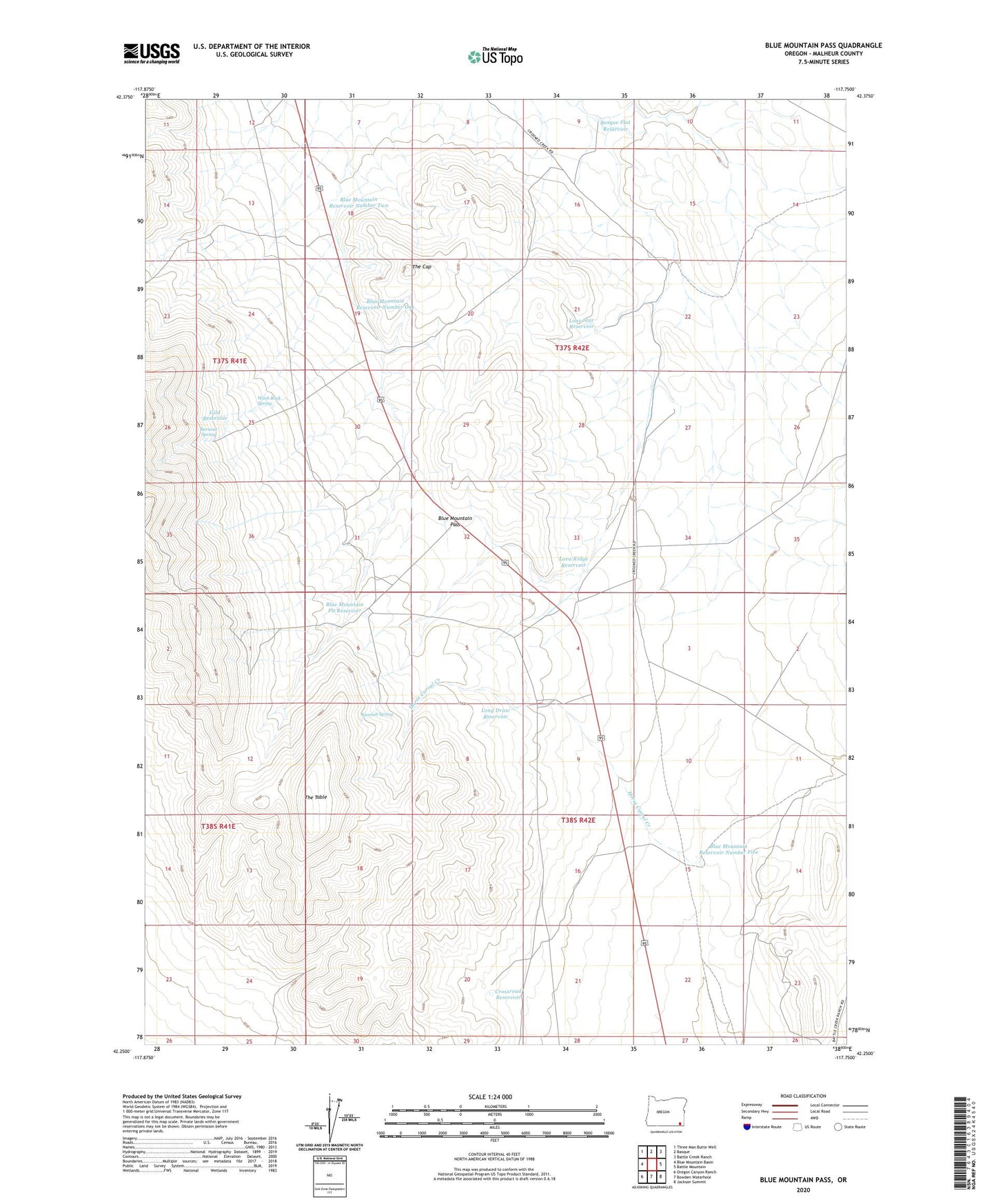
2023 topographic map quadrangle Blue Mountain Pass in the state of Oregon. Scale: 1:24000. Based on the newly updated USGS 7.5' US Topo map series, this map is in the following counties: Malheur. The map contains contour data, water features, and other items you are used to seeing on USGS maps, but also has updated roads and other features. This is the next generation of topographic maps. Printed on high-quality waterproof paper with UV fade-resistant inks.
Quads adjacent to this one:
West: Blue Mountain Basin
Northwest: Three Man Butte Well
North: Basque
Northeast: Battle Creek Ranch
East: Battle Mountain
Southeast: Jackson Summit
South: Bowden Waterhole
Southwest: Oregon Canyon Ranch
This map covers the same area as the classic USGS quad with code o42117c7.
Contains the following named places: Basque Flat Reservoir, Blue Mountain Pass, Blue Mountain Pit Reservoir, Blue Mountain Reservoir Number Five, Blue Mountain Reservoir Number One, Blue Mountain Reservoir Number Two, Burnout Spring, Crossroad Reservoir, Gild Reservoir, Horse Corral Creek, Lava Ridge Reservoir, Lone Star Reservoir, Long Draw Reservoir, Summit Spring, The Cap, The Table, Wash Rock Spring