MyTopo
Oregon Canyon Ranch Oregon US Topo Map
Couldn't load pickup availability
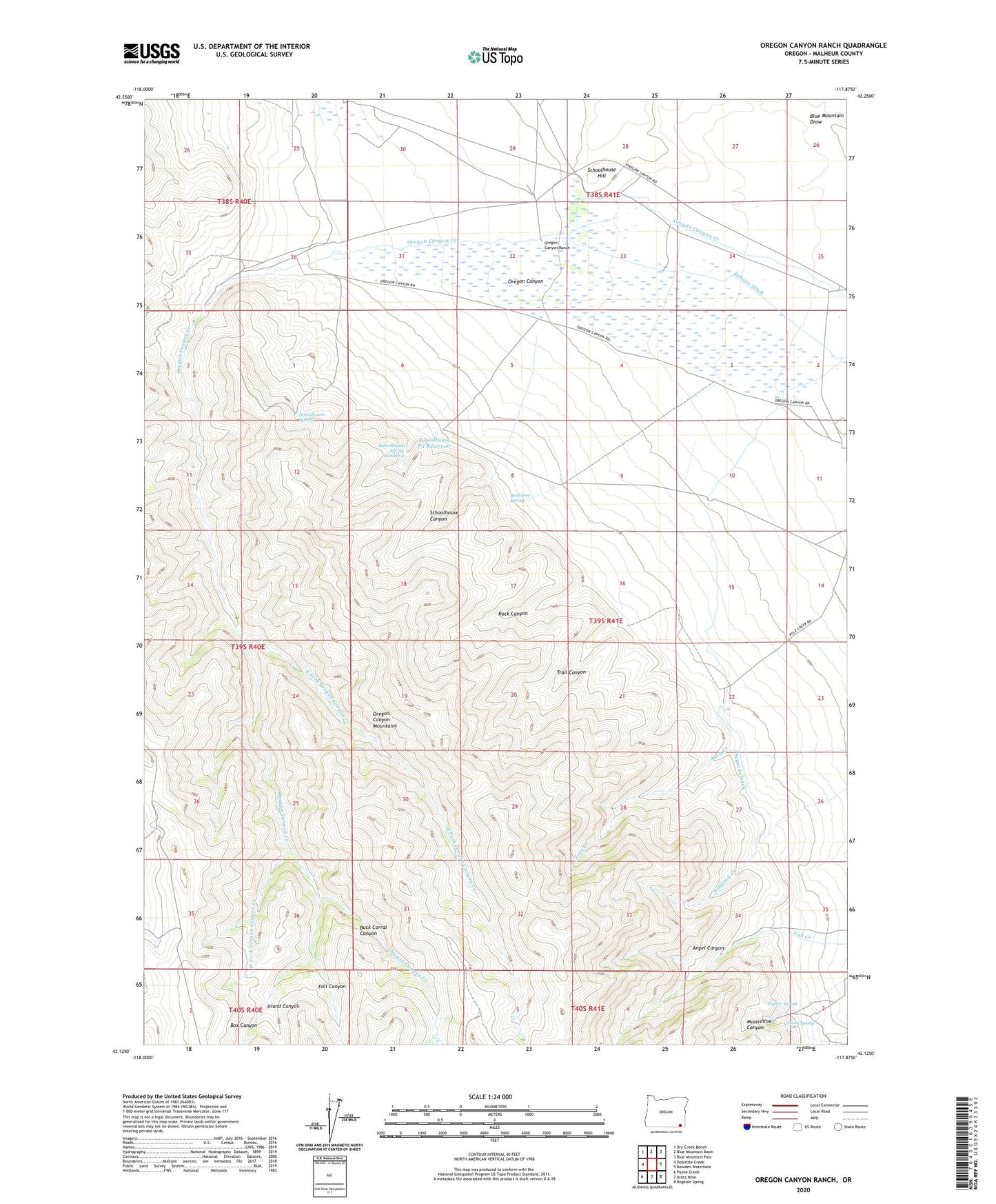
2023 topographic map quadrangle Oregon Canyon Ranch in the state of Oregon. Scale: 1:24000. Based on the newly updated USGS 7.5' US Topo map series, this map is in the following counties: Malheur. The map contains contour data, water features, and other items you are used to seeing on USGS maps, but also has updated roads and other features. This is the next generation of topographic maps. Printed on high-quality waterproof paper with UV fade-resistant inks.
Quads adjacent to this one:
West: Doolittle Creek
Northwest: Dry Creek Bench
North: Blue Mountain Basin
Northeast: Blue Mountain Pass
East: Bowden Waterhole
Southeast: Boghole Spring
South: Bretz Mine
Southwest: Payne Creek
This map covers the same area as the classic USGS quad with code o42117b8.
Contains the following named places: Angel Canyon, Ansotegui Place, Box Canyon, Buck Corral Canyon, Buckaroo Spring, East Fork Oregon Canyon Creek, Echave Ditch, Fall Canyon, Gavica Place, Island Canyon, Jaca Place, Moonshine Canyon, Oregon Canyon, Oregon Canyon Mountains, Oregon Canyon Ranch, Poplar Spring, Rock Canyon, Schoolhouse Canyon, Schoolhouse Hill, Schoolhouse Pit Reservoir, Schoolhouse Spring, Schoolhouse Spring Number 2, Segundo Ditch, Seven Spring, Trail Canyon, West Fork Oregon Canyon Creek