MyTopo
Bonanza Oregon US Topo Map
Couldn't load pickup availability
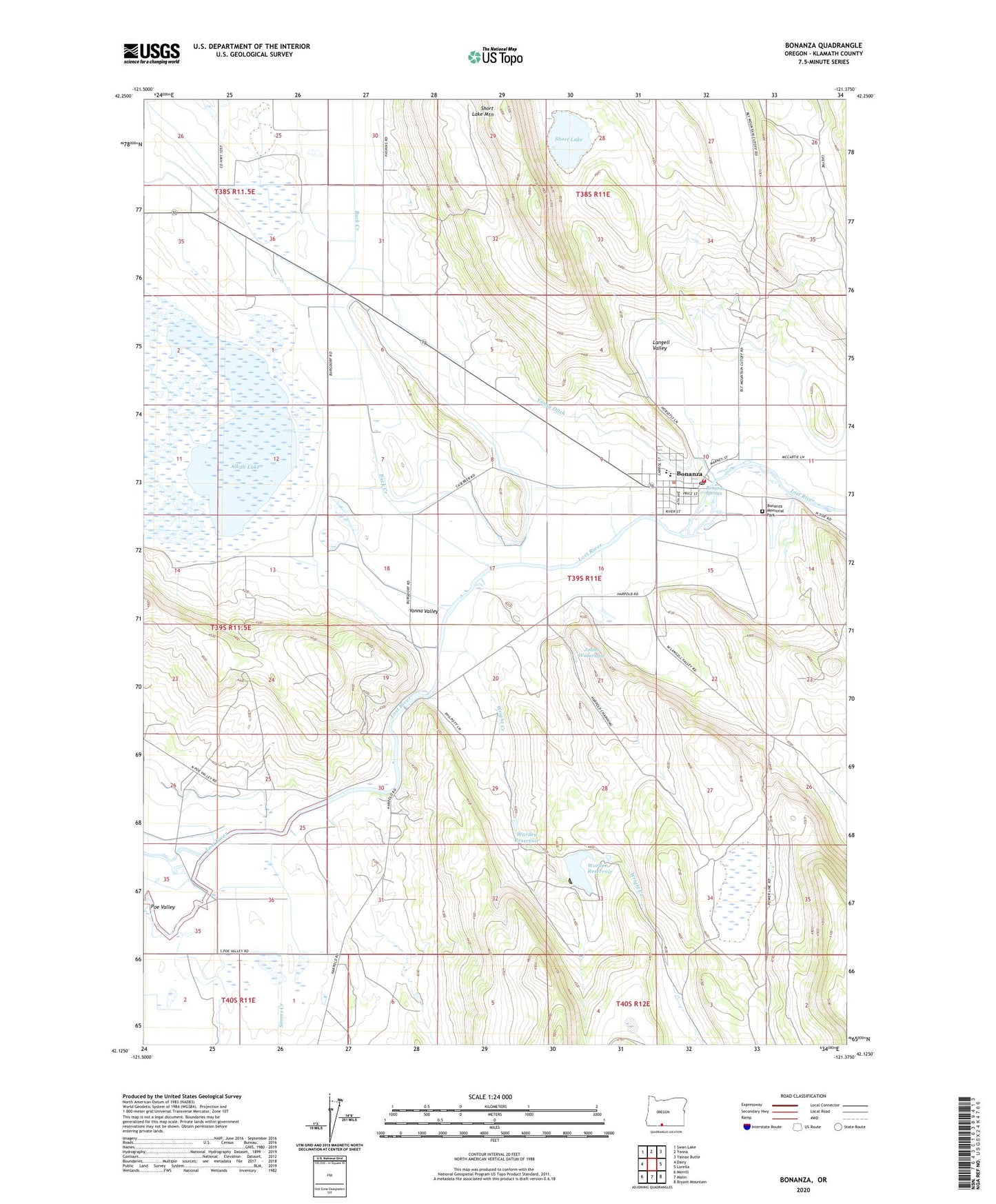
2023 topographic map quadrangle Bonanza in the state of Oregon. Scale: 1:24000. Based on the newly updated USGS 7.5' US Topo map series, this map is in the following counties: Klamath. The map contains contour data, water features, and other items you are used to seeing on USGS maps, but also has updated roads and other features. This is the next generation of topographic maps. Printed on high-quality waterproof paper with UV fade-resistant inks.
Quads adjacent to this one:
West: Dairy
Northwest: Swan Lake
North: Yonna
Northeast: Yainax Butte
East: Lorella
Southeast: Bryant Mountain
South: Malin
Southwest: Merrill
This map covers the same area as the classic USGS quad with code o42121b4.
Contains the following named places: Alkali Lake, Bedfield, Bedfield Post Office, Bonanza, Bonanza Elementary School, Bonanza Junior Senior High School, Bonanza Memorial Park, Bonanza Post Office, Bonanza Rural Fire Protection District, Bonanza Springs, Bonanza Town Hall, Buck Creek, Compressor Station 14 Airstrip, Dairy Pump, Harpold Dam, Johns Waterhole, Klamath County Library Bonanza Branch, Langell Valley, Lytle Pump, Nichols Pump, Seven Springs Ranch, Short Lake, Short Lake Mountain, Simms Creek, Town of Bonanza, Town of Bonanza Sewage Treatment Lagoons, Warden Reservoir, Worden Dam Number Two, Worden Reservoir, Wright Creek, Yonna Ditch, Yonna Valley