MyTopo
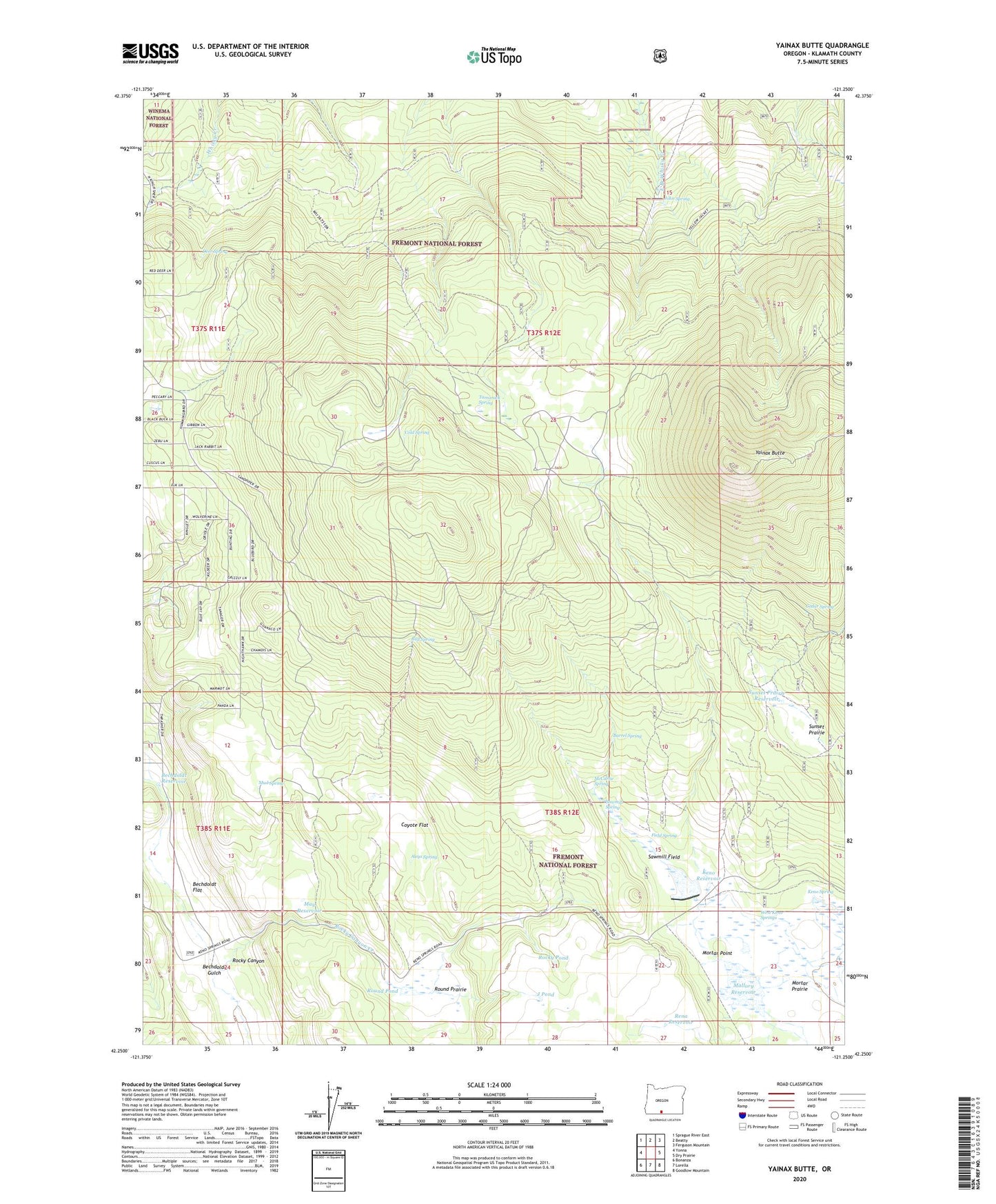
Yainax Butte Oregon US Topo Map
Couldn't load pickup availability
Also explore the Yainax Butte Forest Service Topo of this same quad for updated USFS data
2023 topographic map quadrangle Yainax Butte in the state of Oregon. Scale: 1:24000. Based on the newly updated USGS 7.5' US Topo map series, this map is in the following counties: Klamath. The map contains contour data, water features, and other items you are used to seeing on USGS maps, but also has updated roads and other features. This is the next generation of topographic maps. Printed on high-quality waterproof paper with UV fade-resistant inks.
Quads adjacent to this one:
West: Yonna
Northwest: Sprague River East
North: Beatty
Northeast: Ferguson Mountain
East: Dry Prairie
Southeast: Goodlow Mountain
South: Lorella
Southwest: Bonanza
This map covers the same area as the classic USGS quad with code o42121c3.
Contains the following named places: Aleys Spring, Barrel Spring, Bechdoldt Flat, Bechdoldt Gulch, Bechdoldt Reservoir, Bull Spring, Cedar Spring, Cold Spring, Coyote Flat, Deer Spring, Field Spring, J Pond, John Spring, Keno Dam, Keno Guard Station, Keno Reservoir, Keno Spring, Keno Springs Ranch, Kitts Mill, Mallory Reservoir, May Reservoir, McCartie Reservoir, McCartie Spring, Mortar Point, Mortar Prairie, Mud Spring, Rena Reservoir, Rocky Canyon, Rocky Pond, Round Pond, Round Prairie, Sawmill Field, Sawmill Spring, Sunset Prairie, Sunset Prairie Reservoir, Tamarack Spring, West Keno Springs, Yainax Butte