MyTopo
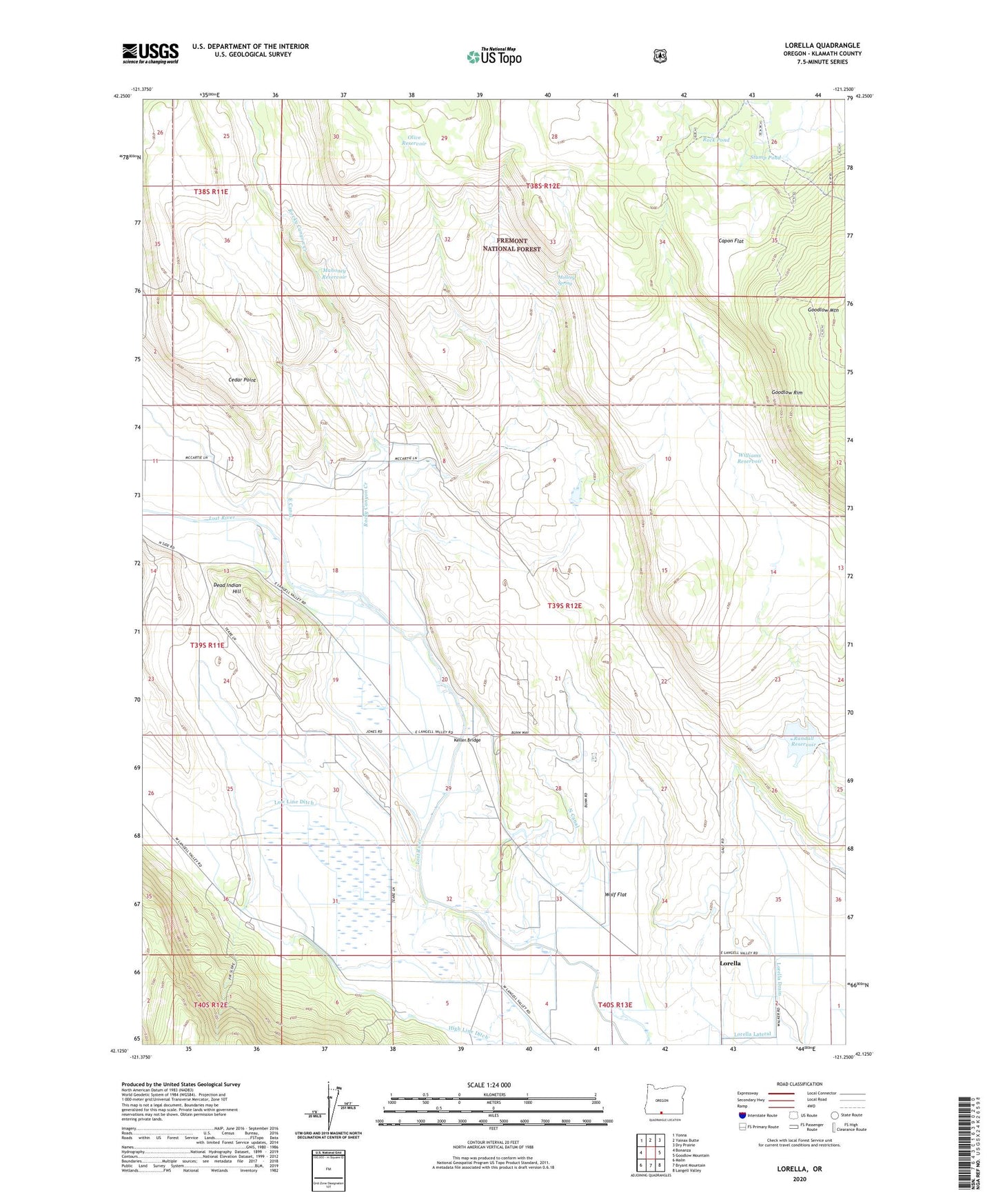
Lorella Oregon US Topo Map
Couldn't load pickup availability
Also explore the Lorella Forest Service Topo of this same quad for updated USFS data
2023 topographic map quadrangle Lorella in the state of Oregon. Scale: 1:24000. Based on the newly updated USGS 7.5' US Topo map series, this map is in the following counties: Klamath. The map contains contour data, water features, and other items you are used to seeing on USGS maps, but also has updated roads and other features. This is the next generation of topographic maps. Printed on high-quality waterproof paper with UV fade-resistant inks.
Quads adjacent to this one:
West: Bonanza
Northwest: Yonna
North: Yainax Butte
Northeast: Dry Prairie
East: Goodlow Mountain
Southeast: Langell Valley
South: Bryant Mountain
Southwest: Malin
This map covers the same area as the classic USGS quad with code o42121b3.
Contains the following named places: Big Springs Pump, Capon Flat, Cedar Point, Dead Indian Hill, East Canal, High Line Ditch, Irwins Pump, Jones Number 2 Pump, Keller Bridge, Lorella, Lorella Drain, Lorella Lateral, Lorella Post Office, Low Line Ditch, Mahoney Reservoir, Mallory Spring, McCartie Ranch, North Canal, Olive Reservoir, Randall Dam, Randall Reservoir, Rock Pond, Rocky Canyon Creek, Stump Pond, Williams Reservoir, Wolf Flat, ZIP Code: 97623