MyTopo
Boulder Butte Oregon US Topo Map
Couldn't load pickup availability
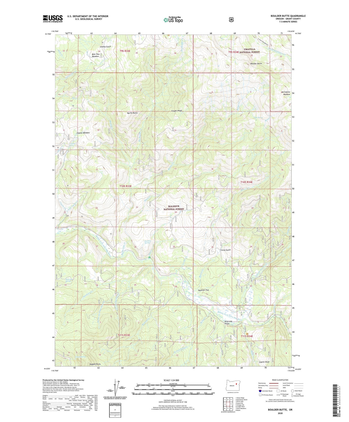
2020 topographic map quadrangle Boulder Butte in the state of Oregon. Scale: 1:24000. Based on the newly updated USGS 7.5' US Topo map series, this map is in the following counties: Grant. The map contains contour data, water features, and other items you are used to seeing on USGS maps, but also has updated roads and other features. This is the next generation of topographic maps. Printed on high-quality waterproof paper with UV fade-resistant inks.
Quads adjacent to this one:
West: Susanville
Northwest: Sharp Ridge
North: Desolation Butte
Northeast: Olive Lake
East: Vinegar Hill
Southeast: Bates
South: Dixie Meadows
Southwest: Cougar Rock
Contains the following named places: Badger Creek, Bear Paw Meadow, Beaver Creek, Big Boulder Creek, Big Boulder Trail, Boulder Butte, Butte Creek, China Diggings, Corey Gulch, Corner Creek, Coyote Bluff, Coyote Creek, Coyote Meadow, Crockett Spring, Dry Creek, East Fork Coyote Creek, East Fork Sunshine Creek, Granite Boulder Creek, Grassy Spring, Haystack Spring, McCalpine Meadow, Middle Fork Sunshine Creek, Myrtle Butte, Myrtle Creek, Plute Spring, Ragged Creek, Ragged Rocks, Reed Mine, Riverside Gulch, Ruby Creek, Squatter Flat, Stalter Mine, Stithum Mine, Sunshine Creek, Sunshine Guard Station, Sunshine Springs, Tincup Creek, Vinegar Hill-Indian Rock Scenic Area, West Fork Ruby Creek, Windlass Creek, Wray Creek, Wray Mine