MyTopo
Olive Lake Oregon US Topo Map
Couldn't load pickup availability
Also explore the Olive Lake Forest Service Topo of this same quad for updated USFS data
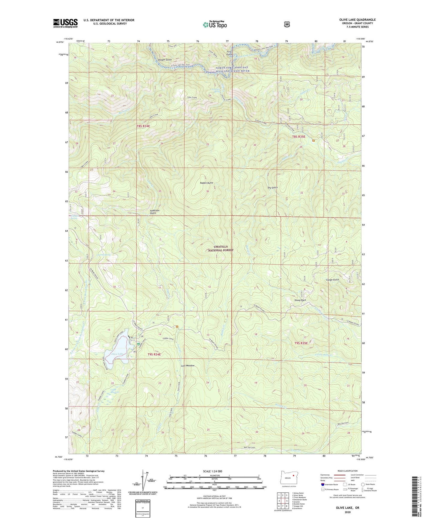
2023 topographic map quadrangle Olive Lake in the state of Oregon. Scale: 1:24000. Based on the newly updated USGS 7.5' US Topo map series, this map is in the following counties: Grant. The map contains contour data, water features, and other items you are used to seeing on USGS maps, but also has updated roads and other features. This is the next generation of topographic maps. Printed on high-quality waterproof paper with UV fade-resistant inks.
Quads adjacent to this one:
West: Desolation Butte
Northwest: Kelsay Butte
North: Silver Butte
Northeast: Trout Meadows
East: Granite
Southeast: Greenhorn
South: Vinegar Hill
Southwest: Boulder Butte
This map covers the same area as the classic USGS quad with code o44118g5.
Contains the following named places: Anderson Gulch, Backout Creek, Ben Camp, Big Meadow Camp, Chinaman Trail, Chrome Spring, Dry Gulch, East Fork of North Fork Desolation Creek, First Gulch, Gold Bug Mine, Granite Creek, Gutridge Mine, Indian Creek, Lake Creek, Lake Creek Trail, Lick Creek, Lost Creek, Lost Creek Camp, Lost Meadow, Olive Lake, Olive Lake Boat Launch, Olive Lake Camp, Olive Lake Dam, Olive Lake Recreation Site, Oregon Gulch, Oregon Gulch Camp, O'Rouick Spring, Pothole Camp, Rabbit Butte, Rabbit Creek, Ranger Station Camp, Rock Spring Camp, Saddle Camp, Sheep Rock, Silver Hill Trail, Snowshoe Spring, Spruce Log Trail, Upper Reservoir, West Fork of North Fork Desolation Creek, Wolsey Creek