MyTopo
Sharp Ridge Oregon US Topo Map
Couldn't load pickup availability
Also explore the Sharp Ridge Forest Service Topo of this same quad for updated USFS data
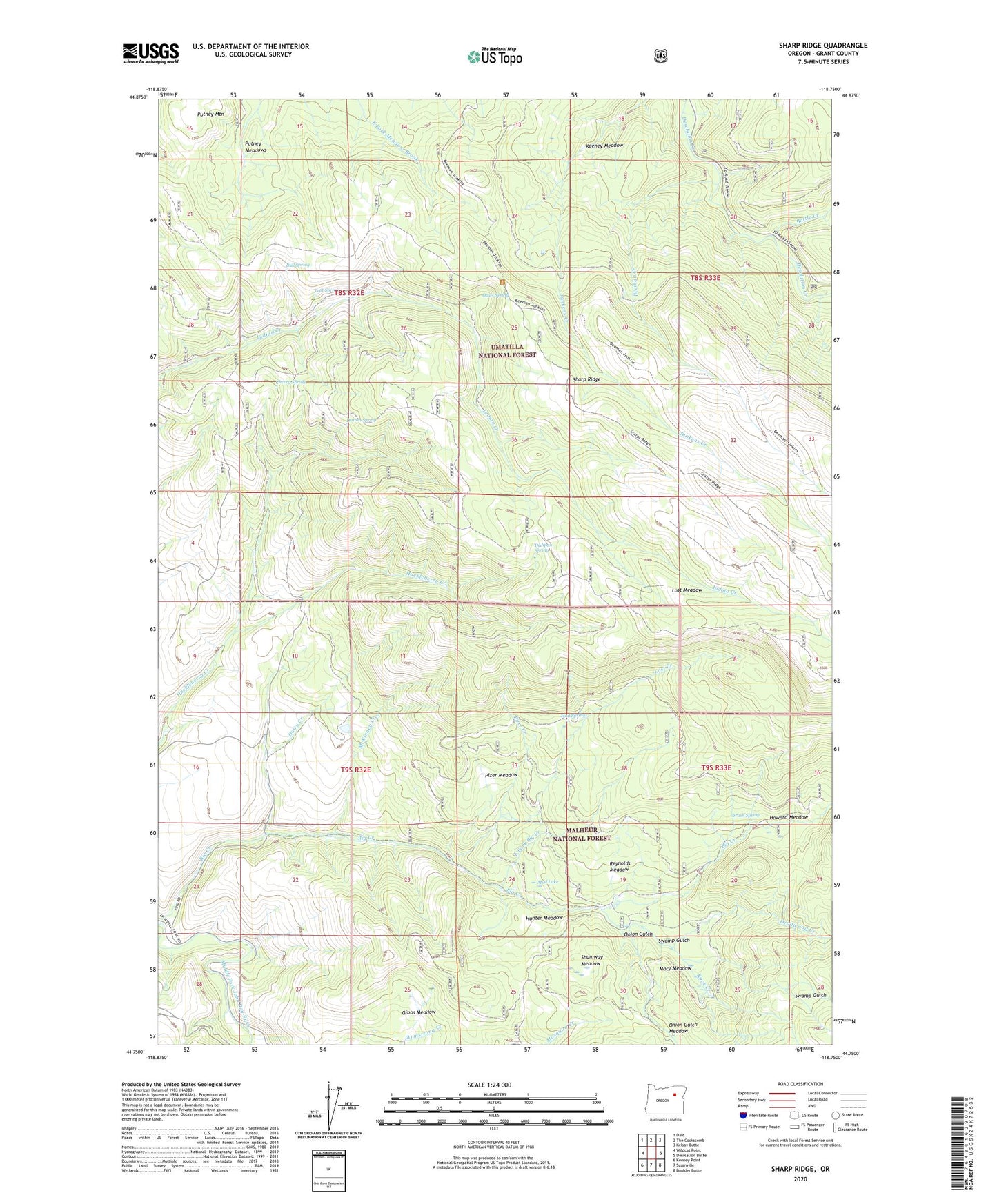
2023 topographic map quadrangle Sharp Ridge in the state of Oregon. Scale: 1:24000. Based on the newly updated USGS 7.5' US Topo map series, this map is in the following counties: Grant. The map contains contour data, water features, and other items you are used to seeing on USGS maps, but also has updated roads and other features. This is the next generation of topographic maps. Printed on high-quality waterproof paper with UV fade-resistant inks.
Quads adjacent to this one:
West: Wildcat Point
Northwest: Dale
North: The Cockscomb
Northeast: Kelsay Butte
East: Desolation Butte
Southeast: Boulder Butte
South: Susanville
Southwest: Keeney Point
This map covers the same area as the classic USGS quad with code o44118g7.
Contains the following named places: Battle Creek, Bear Camp, Bear Camp Trail, Beeman Creek, Beeman Junkens Trail, Big Creek, Brush Spring, Bull Spring, Cherry Spring, Dairy Creek, Deadwood Creek, Dishpan Spring, Dutton Spring, East Fork Big Creek, Gibbs Meadow, Howard Meadow, Howard Meadow Camp, Hunter Meadow, Keeney Camp, Keeney Meadow, Keeney Mine, Lost Creek, Lost Meadow, Lost Spring, Macy Meadow, McKinney Creek, Mud Lake, Mud Springs, Mulkey Spring, Oasis Spring, Onion Gulch, Onion Gulch Meadow, Pizer Creek, Pizer Meadow, Putney Meadows, Putney Mountain, Reynolds Meadow, Rock Creek, Shumway Meadow, Swamp Gulch