MyTopo
Sidwalter Buttes Oregon US Topo Map
Couldn't load pickup availability
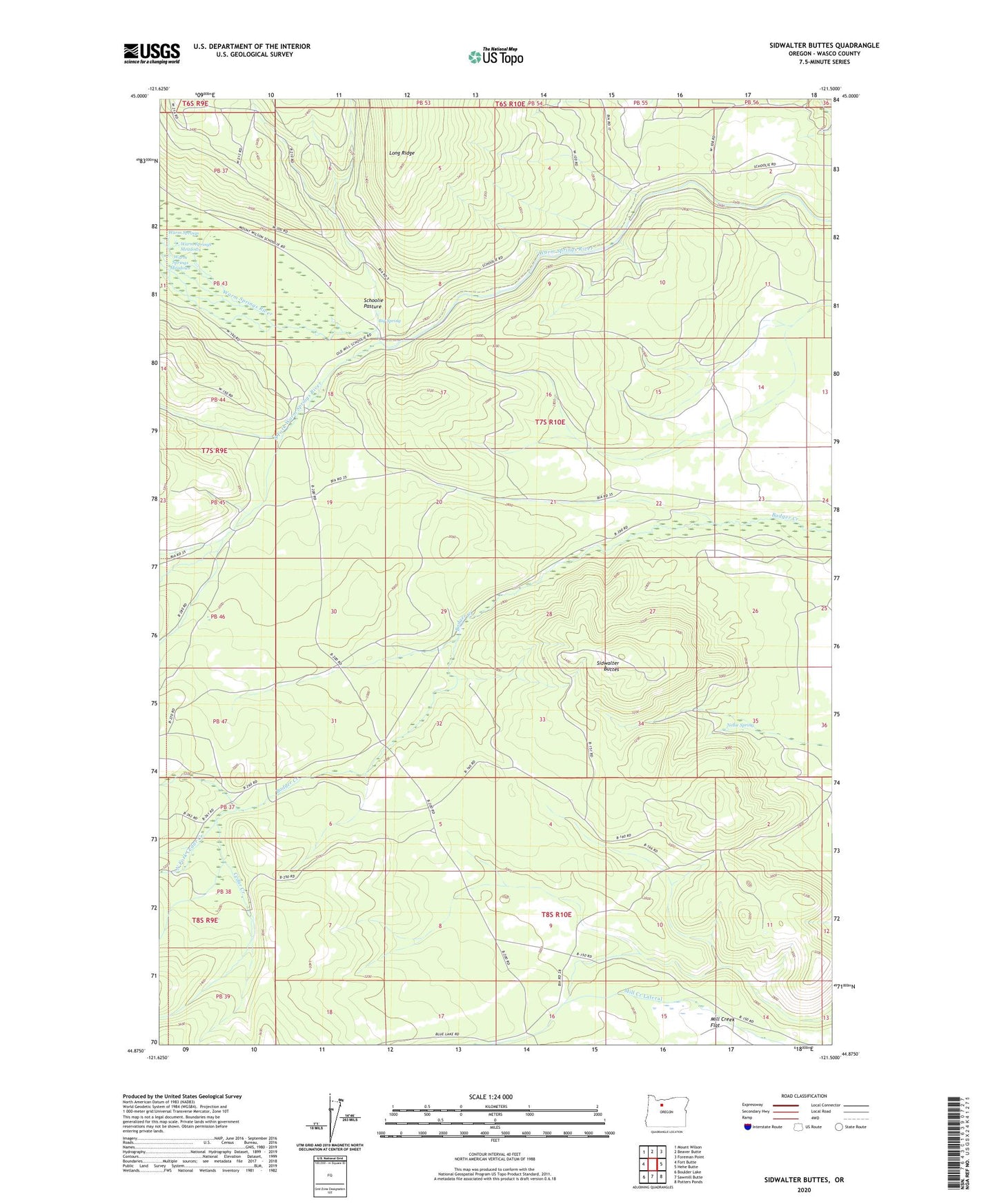
2023 topographic map quadrangle Sidwalter Buttes in the state of Oregon. Scale: 1:24000. Based on the newly updated USGS 7.5' US Topo map series, this map is in the following counties: Wasco. The map contains contour data, water features, and other items you are used to seeing on USGS maps, but also has updated roads and other features. This is the next generation of topographic maps. Printed on high-quality waterproof paper with UV fade-resistant inks.
Quads adjacent to this one:
West: Fort Butte
Northwest: Mount Wilson
North: Beaver Butte
Northeast: Foreman Point
East: Hehe Butte
Southeast: Potters Ponds
South: Sawmill Butte
Southwest: Boulder Lake
This map covers the same area as the classic USGS quad with code o44121h5.
Contains the following named places: Big Spring, Cedar Creek, Nellie Spring, North Fork Cedar Creek, Schoolie Pasture, Schoolie Pasture Ranger Station, Sidwalter Buttes, South Fork Warm Springs River, Warm Springs, Warm Springs Meadows