MyTopo
Brogan Oregon US Topo Map
Couldn't load pickup availability
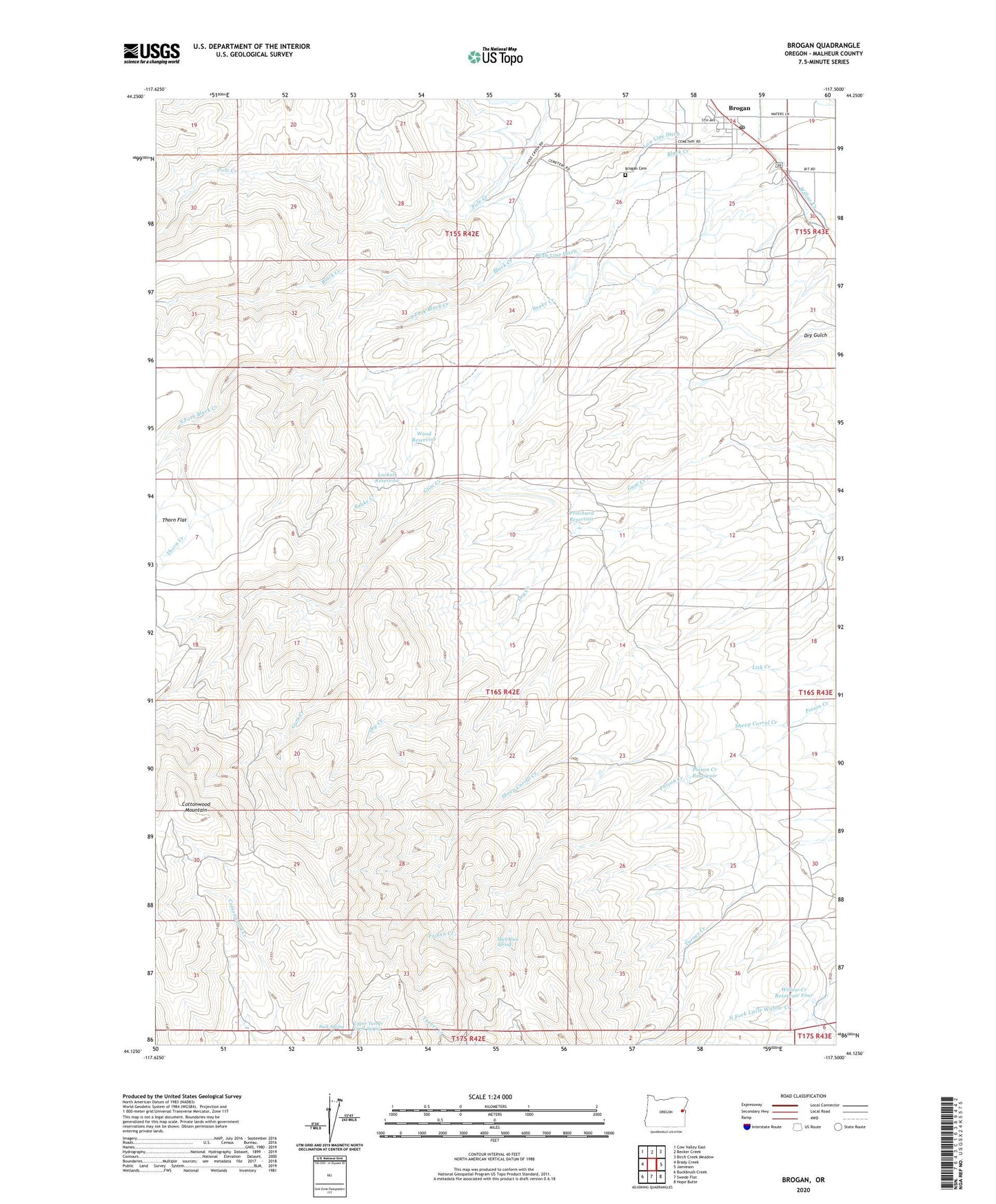
2023 topographic map quadrangle Brogan in the state of Oregon. Scale: 1:24000. Based on the newly updated USGS 7.5' US Topo map series, this map is in the following counties: Malheur. The map contains contour data, water features, and other items you are used to seeing on USGS maps, but also has updated roads and other features. This is the next generation of topographic maps. Printed on high-quality waterproof paper with UV fade-resistant inks.
Quads adjacent to this one:
West: Brady Creek
Northwest: Cow Valley East
North: Becker Creek
Northeast: Birch Creek Meadow
East: Jamieson
Southeast: Hope Butte
South: Swede Flat
Southwest: Buckbrush Creek
This map covers the same area as the classic USGS quad with code o44117b5.
Contains the following named places: Black Creek, Boston Horse Camp, Brogan, Brogan Cemetery, Brogan Census Designated Place, Brogan Elementary School, Brogan Post Office, Buck Spring, Dry Gulch, High Line Ditch, Lockett Reservoir, Lone Tree Ranch, Low Line Ditch, Poison Creek Reservoir, Pritchard Reservoir, Sheep Corral Creek, Shell Rock Spring, Snake Creek, South Fork Black Creek, Thorn Creek, Upper Turner Creek Spring, Willow Creek Reservoir Four, Wood Reservoir