MyTopo
Swede Flat Oregon US Topo Map
Couldn't load pickup availability
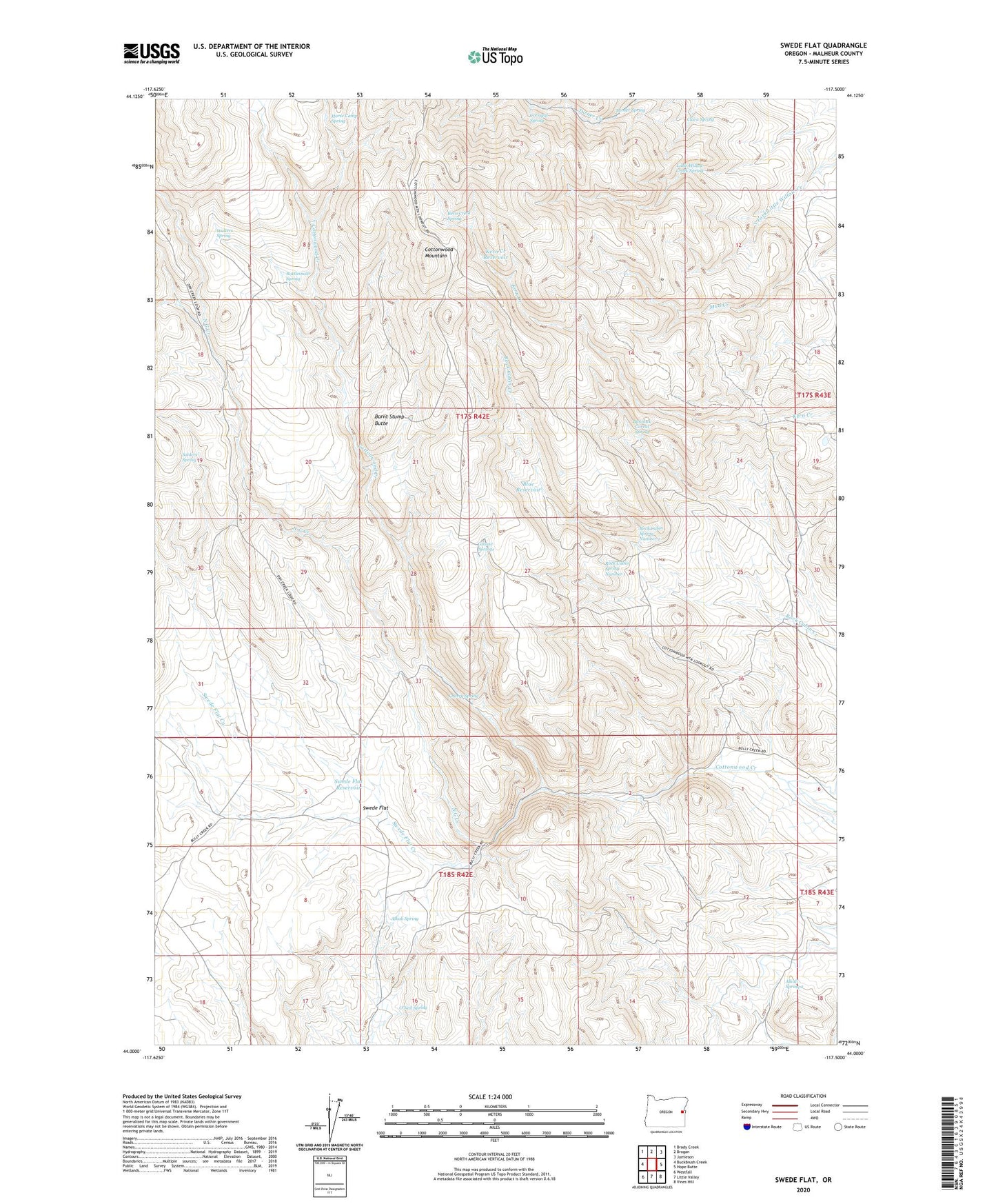
2023 topographic map quadrangle Swede Flat in the state of Oregon. Scale: 1:24000. Based on the newly updated USGS 7.5' US Topo map series, this map is in the following counties: Malheur. The map contains contour data, water features, and other items you are used to seeing on USGS maps, but also has updated roads and other features. This is the next generation of topographic maps. Printed on high-quality waterproof paper with UV fade-resistant inks.
Quads adjacent to this one:
West: Buckbrush Creek
Northwest: Brady Creek
North: Brogan
Northeast: Jamieson
East: Hope Butte
Southeast: Vines Hill
South: Little Valley
Southwest: Westfall
This map covers the same area as the classic USGS quad with code o44117a5.
Contains the following named places: Alkali Spring, Alkali Spring 2, Bannock Corral Spring, Blue Reservoir, Burnt Stump Butte, Cherry Spring, Clara Spring, Corrigal Spring, Grouse Springs, Horse Camp Spring, Kern Creek Reservoir, Kern Creek Spring, Little Willow Creek Spring, N G Creek, O'Neil Spring, Rattlesnake Reservoir, Rattlesnake Spring, Rock Cabin Spring Number 1, Rock Cabin Spring Number 2, Solders Spring, Swede Flat, Swede Flat Creek, Swede Flat Reservoir, Turner Spring, Walters Spring