MyTopo
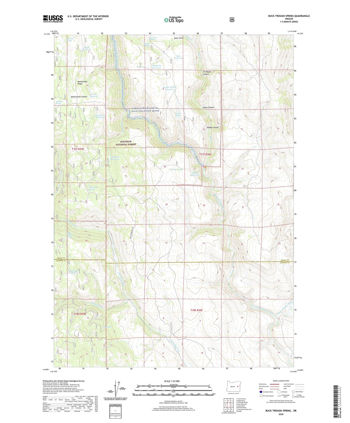
Buck Trough Spring Oregon US Topo Map
Couldn't load pickup availability
Also explore the Buck Trough Spring Forest Service Topo of this same quad for updated USFS data
2023 topographic map quadrangle Buck Trough Spring in the state of Oregon. Scale: 1:24000. Based on the newly updated USGS 7.5' US Topo map series, this map is in the following counties: Grant, Harney. The map contains contour data, water features, and other items you are used to seeing on USGS maps, but also has updated roads and other features. This is the next generation of topographic maps. Printed on high-quality waterproof paper with UV fade-resistant inks.
Quads adjacent to this one:
West: Knox Mountain
Northwest: Crane Prairie
North: Flag Prairie
Northeast: Clevenger Butte
East: Castle Rock
Southeast: Beulah
South: Cottonwood Reservoir
Southwest: Otis Mountain
This map covers the same area as the classic USGS quad with code o44118a3.
Contains the following named places: Anderson Spring, Bathtub Spring, Bear Creek, Breaks Reservoir, Buck Trough Spring, Chalk Reservoir, Dead Horse Reservoir, Flag Creek, Forks Reservoir, Happy Canyon, Little Malheur River, Lost Spring, Mahogany Spring, Pine Tree Spring, Powder Spring Reservoir, Red Trough Spring, Sidehill Spring, Sixtynine Reservoir, Skagway Creek, Skagway Reservoir, Slate Reservoir, Smith Canyon, Tamarack Creek, Tin Wagon Canyon, TJW Reservoir, Tureman Spring