MyTopo
Bullards Oregon US Topo Map
Couldn't load pickup availability
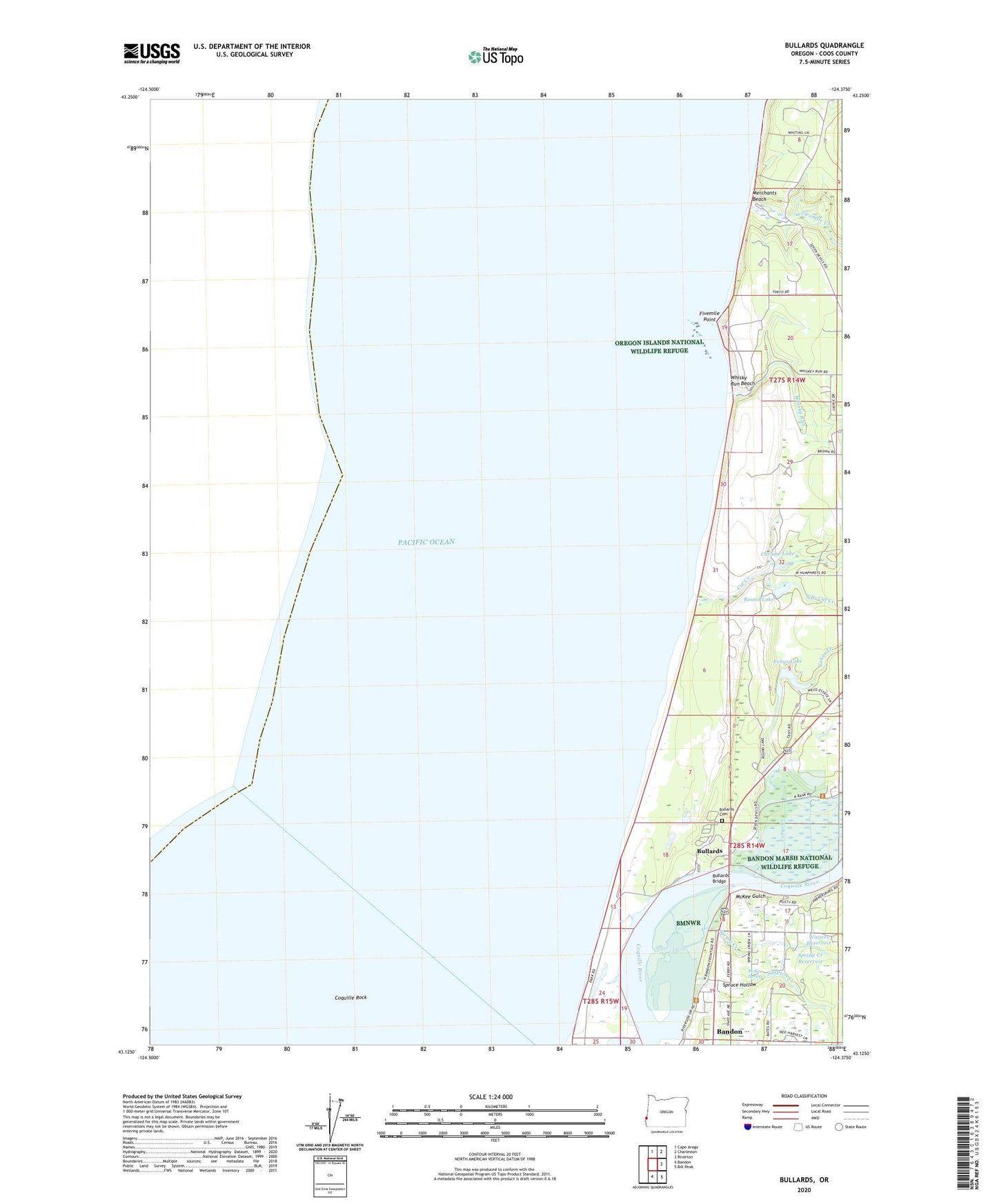
2024 topographic map quadrangle Bullards in the state of Oregon. Scale: 1:24000. Based on the newly updated USGS 7.5' US Topo map series, this map is in the following counties: Coos. The map contains contour data, water features, and other items you are used to seeing on USGS maps, but also has updated roads and other features. This is the next generation of topographic maps. Printed on high-quality waterproof paper with UV fade-resistant inks.
Quads adjacent to this one:
North: Cape Arago
Northeast: Charleston
East: Riverton
Southeast: Bill Peak
South: Bandon
This map covers the same area as the classic USGS quad with code o43124b4.
Contains the following named places: Bandon Marsh National Wildlife Refuge, Bullards, Bullards Beach State Park, Bullards Beach State Park Boat Ramp, Bullards Beach State Park Sewage Treatment Plant, Bullards Bridge, Bullards Family Cemetery, Bullards Post Office, Chrome Lake, Coquille Rock, Cranberry Corners, Cut Creek, Fahys Creek, Fahys Lake, Fivemile Point, McKee Gulch, McKee Spring, Merchants Beach, Round Lake, Seven Devils State Park, Simpson Creek, South Branch Cut Creek, Spring Creek, Spring Creek Reservoir, Spruce Hollow, The Lagoon, Twomile Creek, Whisky Run, Whisky Run Beach, Winters Reservoir