MyTopo
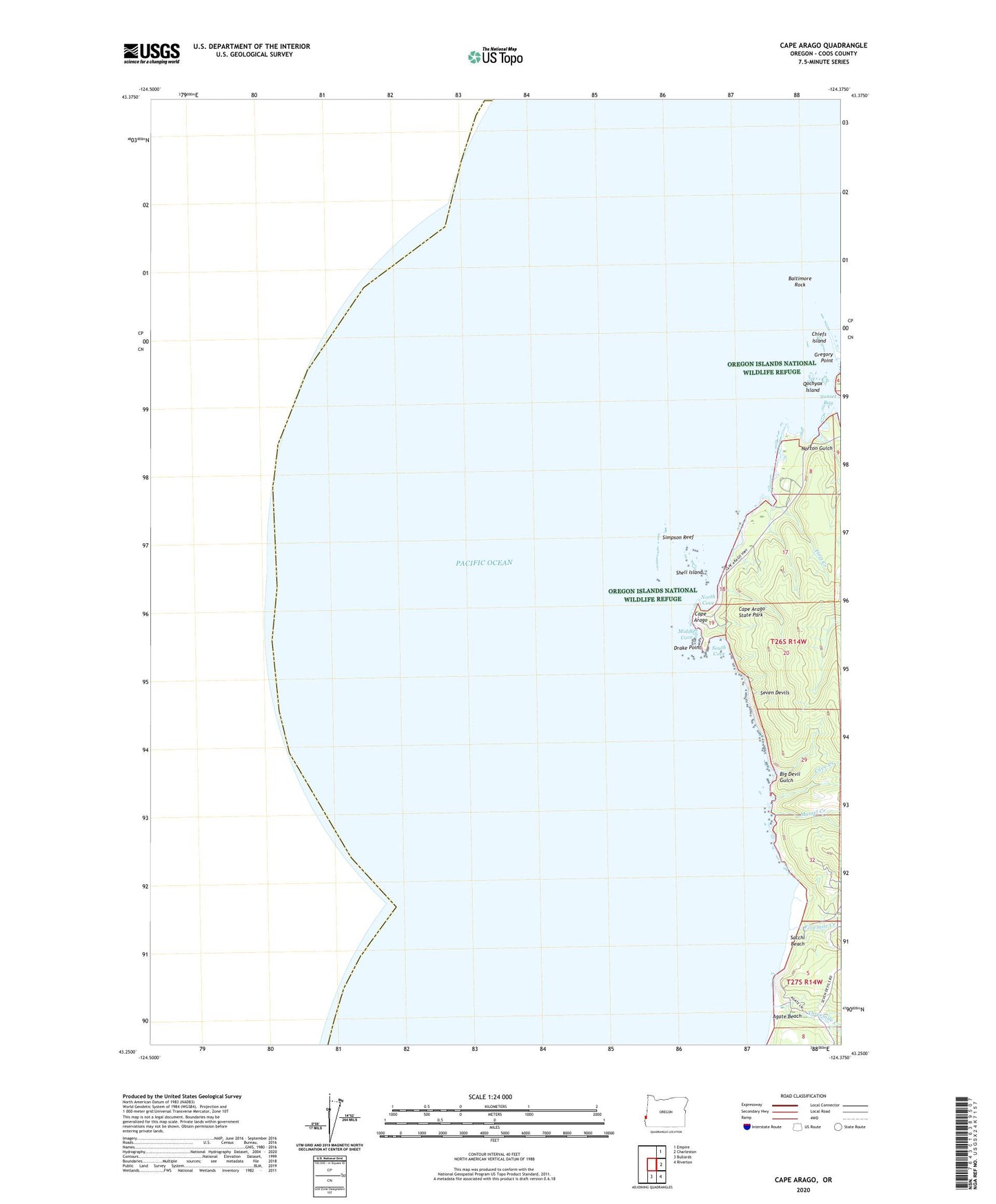
Cape Arago Oregon US Topo Map
Couldn't load pickup availability
2024 topographic map quadrangle Cape Arago in the state of Oregon. Scale: 1:24000. Based on the newly updated USGS 7.5' US Topo map series, this map is in the following counties: Coos. The map contains contour data, water features, and other items you are used to seeing on USGS maps, but also has updated roads and other features. This is the next generation of topographic maps. Printed on high-quality waterproof paper with UV fade-resistant inks.
Quads adjacent to this one:
Northeast: Empire
East: Charleston
Southeast: Riverton
South: Bullards
This map covers the same area as the classic USGS quad with code o43124c4.
Contains the following named places: Agate Beach, Baltimore Rock, Big Creek, Big Devil Gulch, Cape Arago, Cape Arago Lighthouse, Cape Arago State Park, Cave Creek, Chiefs Island, Drake Point, First Creek, Fivemile Creek, Gregory Point, Middle Cove, Mussel Creek, North Cove, Norton Gulch, Qochyax Island, Sacchi Beach, Sea Lion View Point, Seven Devils, Shell Island, Shore Acres, Shore Acres State Park, Simpson Reef, South Cove, Sunset Bay, Threemile Creek