MyTopo
Mount Thielsen Oregon US Topo Map
Couldn't load pickup availability
Also explore the Mount Thielsen Forest Service Topo of this same quad for updated USFS data
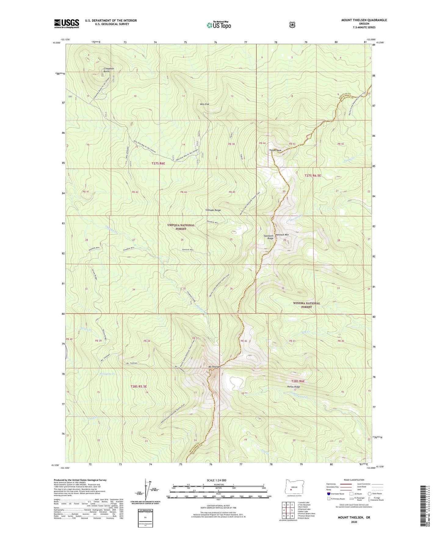
2023 topographic map quadrangle Mount Thielsen in the state of Oregon. Scale: 1:24000. Based on the newly updated USGS 7.5' US Topo map series, this map is in the following counties: Douglas, Klamath. The map contains contour data, water features, and other items you are used to seeing on USGS maps, but also has updated roads and other features. This is the next generation of topographic maps. Printed on high-quality waterproof paper with UV fade-resistant inks.
Quads adjacent to this one:
West: Diamond Lake
Northwest: Lemolo Lake
North: Tolo Mountain
Northeast: Burn Butte
East: Miller Lake
Southeast: Welch Butte
South: Pumice Desert East
Southwest: Pumice Desert West
This map covers the same area as the classic USGS quad with code o43122b1.
Contains the following named places: Cinnamon Butte, Hollys Ridge, Howlock Mountain, Lathrop Glacier, Mount Thielsen, Mount Thielsen Wilderness, Sawtooth Ridge, Thielsen Camp, Thielsen Creek Recreation Site, Thielsen Creek Trail, Tipsoo Peak, Tipsoo Trail, Wits End