
MyTopo
Calf Ranch Mountain Oregon US Topo Map
Couldn't load pickup availability
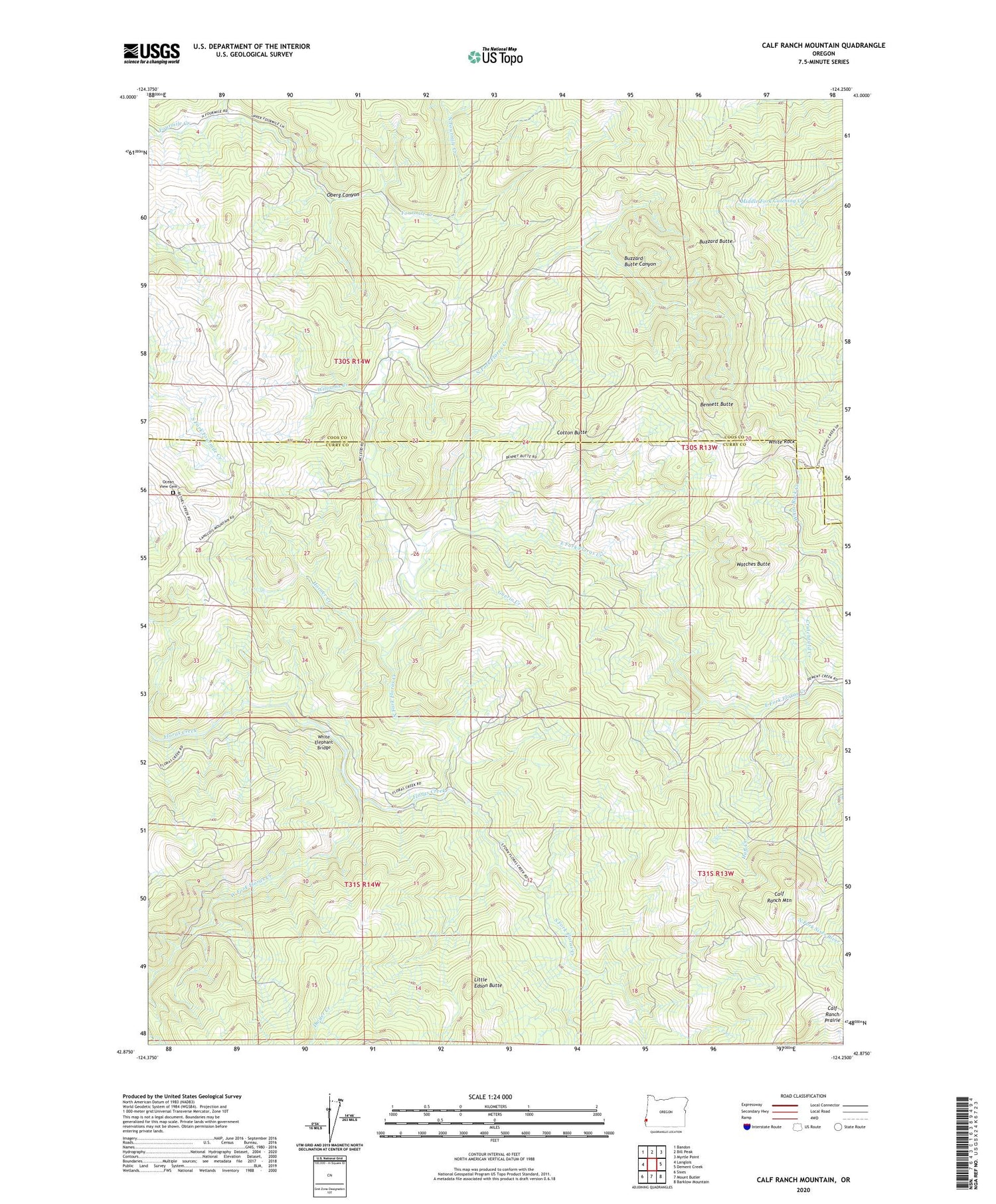
2020 topographic map quadrangle Calf Ranch Mountain in the state of Oregon. Scale: 1:24000. Based on the newly updated USGS 7.5' US Topo map series, this map is in the following counties: Curry, Coos. The map contains contour data, water features, and other items you are used to seeing on USGS maps, but also has updated roads and other features. This is the next generation of topographic maps. Printed on high-quality waterproof paper with UV fade-resistant inks.
Quads adjacent to this one:
West: Langlois
Northwest: Bandon
North: Bill Peak
Northeast: Myrtle Point
East: Dement Creek
Southeast: Barklow Mountain
South: Mount Butler
Southwest: Sixes
Contains the following named places: Bennett Butte, Bennett Post Office, Buzzard Butte, Buzzard Butte Canyon, Calf Ranch Mountain, Calf Ranch Prairie, Camp Fir Croft, Cotton Butte, Crutchfield Creek, Doe Camp, Dwyer Creek, East Fork Floras Creek, Guerin Creek, Hare, Hare Post Office, Horner Creek, Huff Creek, Little Creek, Little Edson Butte, North Fork Floras Creek, North Fourmile Creek, Oberg Canyon, Ocean View Cemetery, Okietown, South Fork Floras Creek, Triangle Post Office, Watches Butte, West Fork Floras Creek, White Elephant Bridge, White Rock, Williams Creek


