MyTopo
Sixes Oregon US Topo Map
Couldn't load pickup availability
Also explore the Sixes Forest Service Topo of this same quad for updated USFS data
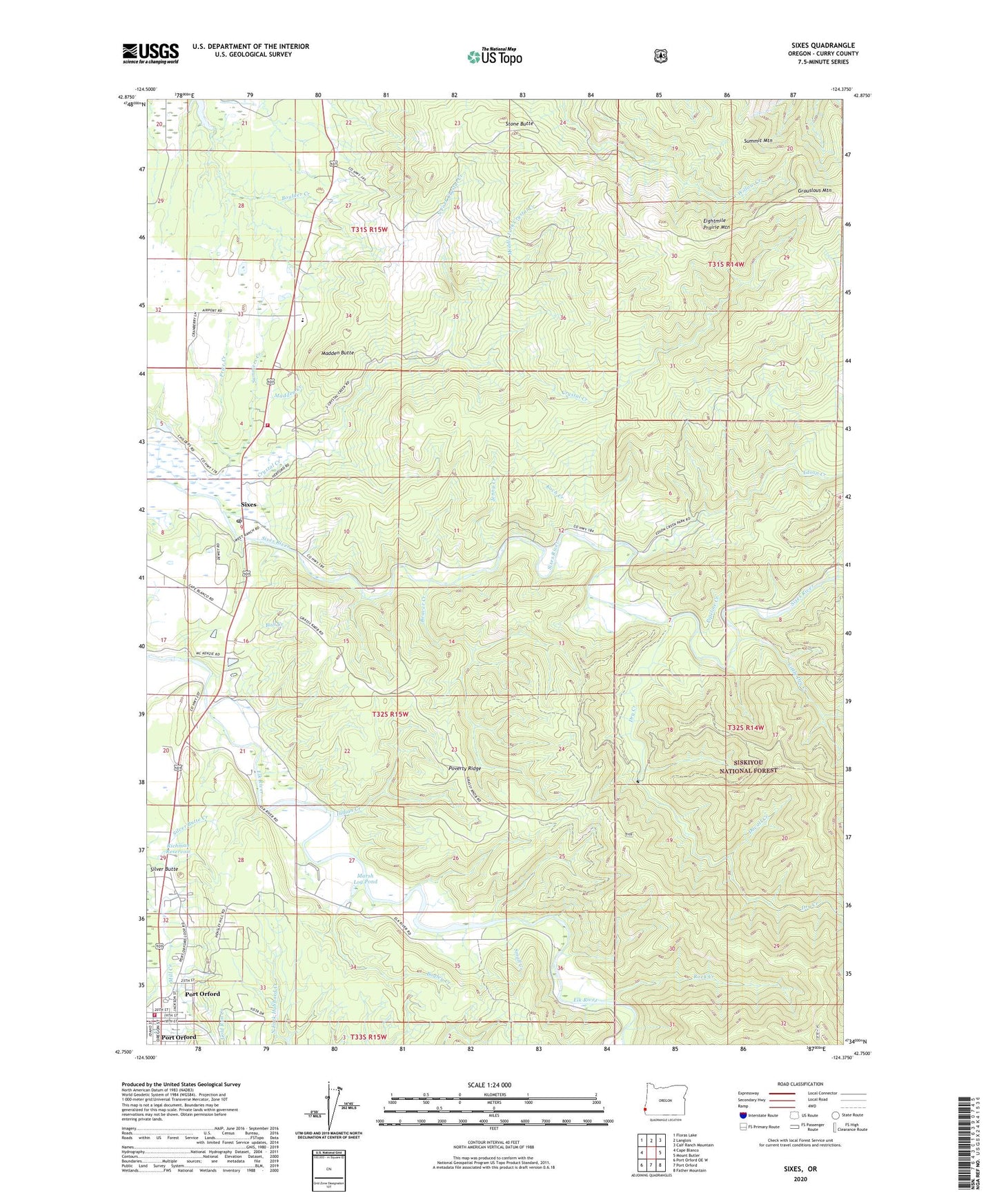
2023 topographic map quadrangle Sixes in the state of Oregon. Scale: 1:24000. Based on the newly updated USGS 7.5' US Topo map series, this map is in the following counties: Curry. The map contains contour data, water features, and other items you are used to seeing on USGS maps, but also has updated roads and other features. This is the next generation of topographic maps. Printed on high-quality waterproof paper with UV fade-resistant inks.
Quads adjacent to this one:
West: Cape Blanco
Northwest: Floras Lake
North: Langlois
Northeast: Calf Ranch Mountain
East: Mount Butler
Southeast: Father Mountain
South: Port Orford
Southwest: Port Orford OE W
This map covers the same area as the classic USGS quad with code o42124g4.
Contains the following named places: Bagley Creek, Beaver Creek, Brush Prairie, Bull Creek, Crystal Creek, Dry Creek, Duvall Creek, Edson Creek, Edson Creek Boat Ramp, Edson Creek Campground, Eightmile Prairie, Eightmile Prairie Mountain, First Community Church of Port Orford, Grassy Knob Trail, Grouslous Mountain, Indian Creek, Iron Head Boat Launch, Jenny Creek, Koch Creek, Little Dry Creek, Madden Butte, Madden Creek, Marsh Log Pond, Mid - Drift Boat Launch, Middle Fork Crystal Creek, North Fork Crystal Creek, Pacific High School, Pipeline Creek, Port Orford Cedar Forest State Wayside, Port Orford City Hall, Port Orford Community Ambulance, Port Orford Division, Port Orford Municipal Court, Port Orford Police Department, Port Orford Public Works, Port Orford Volunteer Fire Department, Poverty Ridge, Price Creek, Richman Reservoir, Rock Creek, Saddle Rock, Silver Butte, Silver Butte Creek, Sixes, Sixes Post Office, Sixes River Store Boat Launch, Sixes Rural Fire Protection, Small Creek, Stone Butte, Summers Creek, Summit Mountain, Zion Lutheran Church, ZIP Code: 97476