MyTopo
Barklow Mountain Oregon US Topo Map
Couldn't load pickup availability
Also explore the Barklow Mountain Forest Service Topo of this same quad for updated USFS data
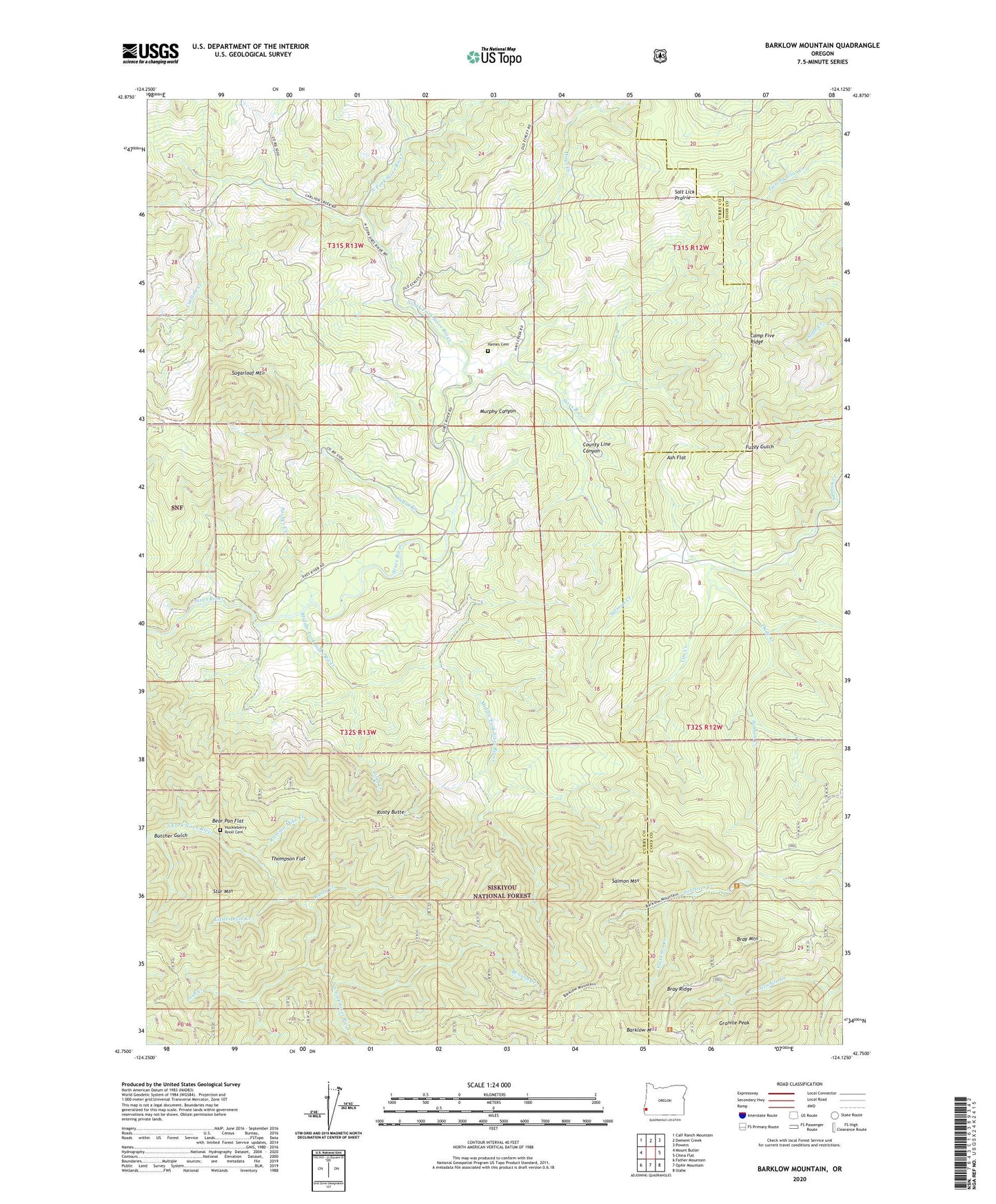
2024 topographic map quadrangle Barklow Mountain in the state of Oregon. Scale: 1:24000. Based on the newly updated USGS 7.5' US Topo map series, this map is in the following counties: Curry, Coos. The map contains contour data, water features, and other items you are used to seeing on USGS maps, but also has updated roads and other features. This is the next generation of topographic maps. Printed on high-quality waterproof paper with UV fade-resistant inks.
Quads adjacent to this one:
West: Mount Butler
Northwest: Calf Ranch Mountain
North: Dement Creek
Northeast: Powers
East: China Flat
Southeast: Illahe
South: Ophir Mountain
Southwest: Father Mountain
This map covers the same area as the classic USGS quad with code o42124g2.
Contains the following named places: Ash Flat, Avery Ranch, Barklow Mountain, Barklow Mountain Campground, Bear Pan Flat, Benson Creek, Blue Jay Mine, Bray Mountain, Bray Ridge, Butcher Gulch, Camp Five Ridge, Carlton Creek, Carlton Prairie, Cold Creek, County Line Canyon, Dement Ranch, Dixie Creek, Dude Creek, Eckley, Eckley Post Office, Flannigan Creek, Florence Creek, Granite Creek, Granite Peak, Guerin Prairie, Haines Cemetery, Haines Creek, Hays Creek, High Prairie, Huckleberry Knoll Cemetery, Josh Creek, Little Dixie Creek, McFarlin, Middle Fork Sixes River, Murphy Canyon, North Fork Sixes River, Powers Ranch, Riggs Creek, Russian Mike Creek, Rusty Butte, Rusty Creek, Salmon Creek, Salmon Mountain, Salt Lick Prairie, Star Mountain, Sucker Creek, Sugar Creek, Sugarloaf Mountain, Thompson Flat, Tim Creek