MyTopo
Empire Oregon US Topo Map
Couldn't load pickup availability
Also explore the Empire Forest Service Topo of this same quad for updated USFS data
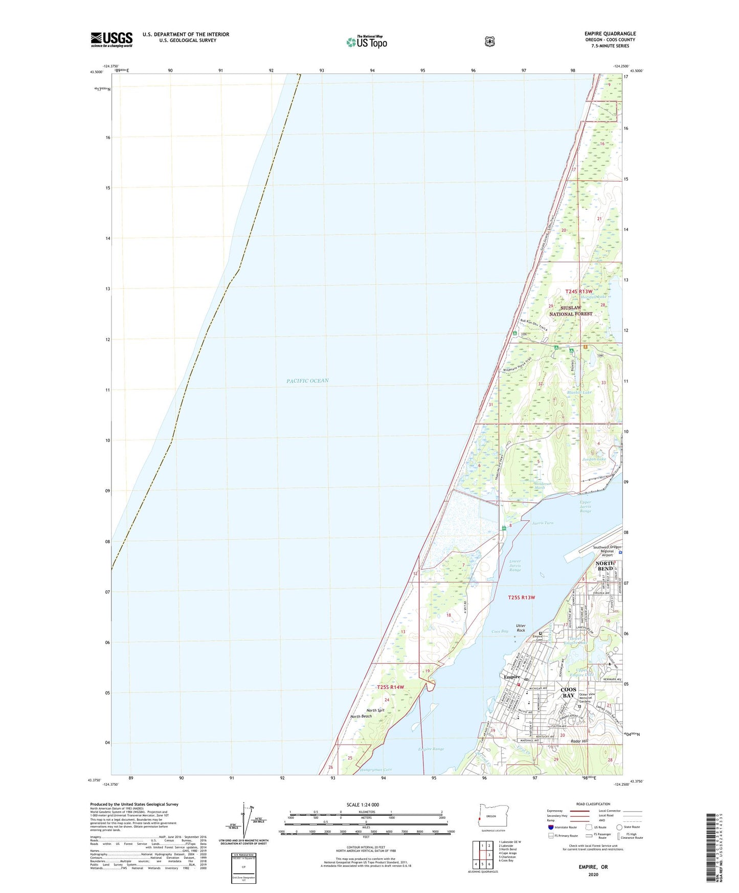
2024 topographic map quadrangle Empire in the state of Oregon. Scale: 1:24000. Based on the newly updated USGS 7.5' US Topo map series, this map is in the following counties: Coos. The map contains contour data, water features, and other items you are used to seeing on USGS maps, but also has updated roads and other features. This is the next generation of topographic maps. Printed on high-quality waterproof paper with UV fade-resistant inks.
Quads adjacent to this one:
North: Lakeside OE W
Northeast: Lakeside
East: North Bend
Southeast: Coos Bay
South: Charleston
Southwest: Cape Arago
This map covers the same area as the classic USGS quad with code o43124d3.
Contains the following named places: Airport Heights Park, Bluebill Lake, Bluebill Recreation Site, Bureau of Land Management Coos Bay District Office, Camp Castaway, Chickses Creek, Coos Bay Empire Sewage Treatment Plant, Coos Bay Fire Department Empire Station, Elkhorn Post Office, Empire, Empire Boat Ramp, Empire Cemetery, Empire Lakes, Empire Post Office, Empire Range, First Creek, Henderson Marsh, Horsfall Beach Recreation Site, Horsfall Lake, Hungryman Cove, Jarvis Turn, John Topits Empire Lower Lake Boat Ramp, John Topits Empire Middle Lake Boat Ramp, John Topits Park, Jordan Lake, Lower Empire Lake, Lower Empire Lake Dam, Lower Jarvis Range, Madison Elementary School, Market Post Office, Middle Empire Lake, Middle Empire Lake Dam, Navy 11088 Post Office, North Beach, North Bend Sewage Treatment Plant, North Spit, North Spit Boat Dock, Ocean View Memorial Gardens, On Broadway Thespians Dinner Theatre, Oregon State Police Department Coos Bay Area Command, Radar Hill, Red Cross Coos Bay Satellite Office, Roseburg Lumber Chip Facility Airstrip, Second Creek, Sitka Dock, Southwestern Oregon Community College, Southwestern Oregon Community College Hales Center for the Performing Arts, Southwestern Oregon Community College Library, Southwestern Oregon Community College Poets Eye Outdoor Theatre, Sunset Middle School, Taylor/Wasson Park, Upper Empire Lake, Upper Jarvis Range, Utter Rock, Wild Mare Horse Camp