MyTopo
Cathlamet Bay Oregon US Topo Map
Couldn't load pickup availability
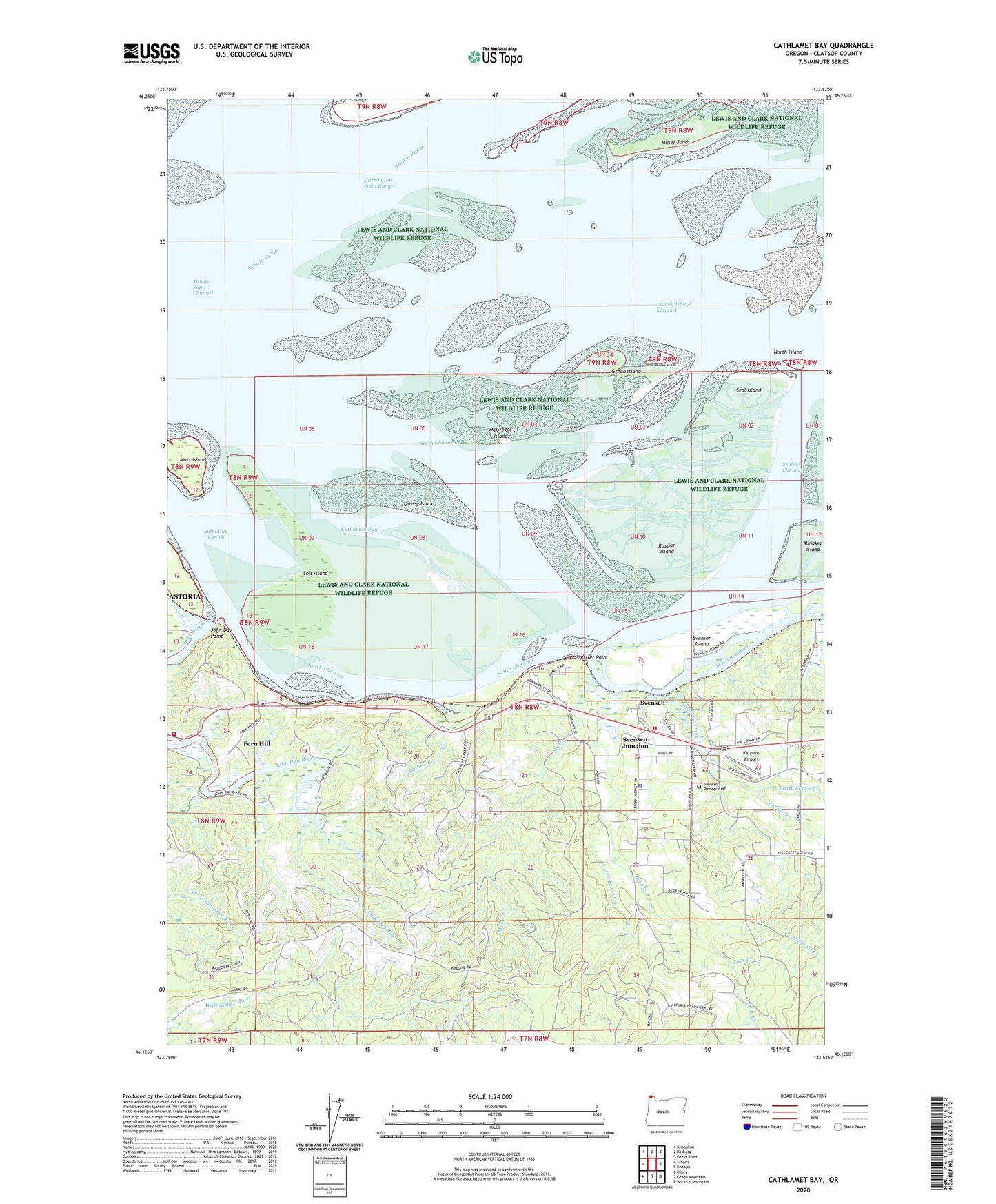
2024 topographic map quadrangle Cathlamet Bay in the state of Oregon. Scale: 1:24000. Based on the newly updated USGS 7.5' US Topo map series, this map is in the following counties: Clatsop. The map contains contour data, water features, and other items you are used to seeing on USGS maps, but also has updated roads and other features. This is the next generation of topographic maps. Printed on high-quality waterproof paper with UV fade-resistant inks.
Quads adjacent to this one:
West: Astoria
Northwest: Knappton
North: Rosburg
Northeast: Grays River
East: Knappa
Southeast: Wickiup Mountain
South: Green Mountain
Southwest: Olney
This map covers the same area as the classic USGS quad with code o46123b6.
Contains the following named places: Beacon Number Four, Beacon Number Two, Bear Creek, Biddle, Big Creek Slough, Burnside, Calendar Slough, Cathlamet Bay, Clatsop County Sheriff's Office Columbia River Valley Police Substation, Davis Creek, East Light, Eskeline Creek, Fern Hill, Fern Hill Post Office, Fernhill, Fernhill Holly Farms, Ferris Creek, Front Range Light, Grassy Island, Green Island, Harrington Point Range, Hilda Lahti Elementary School, Hillcrest Creek, Ivy Station, John Day Channel, John Day County Park, John Day Point, John Day River, John Day Rural Fire Protection Department, Karpens Airport, Knappa Svensen Rural Fire Protection Department Station 2, Little Bear Creek, Little Ferris Creek, Lois Island, Marys Creek, McGregor Island, Miller Sands, Mott Island, North Channel, North Island, Prairie Channel, Rear Range Light, Rock Creek, Russian Island, Seal Island, Settler Point, South Channel, Spear Creek, Svensen, Svensen Census Designated Place, Svensen Island, Svensen Junction, Svensen Pioneer Cemetery, Svensen Post Office, Svensen School, Svensen Slough, West Light, Woody Island Channel, ZIP Code: 97103