MyTopo
Olney Oregon US Topo Map
Couldn't load pickup availability
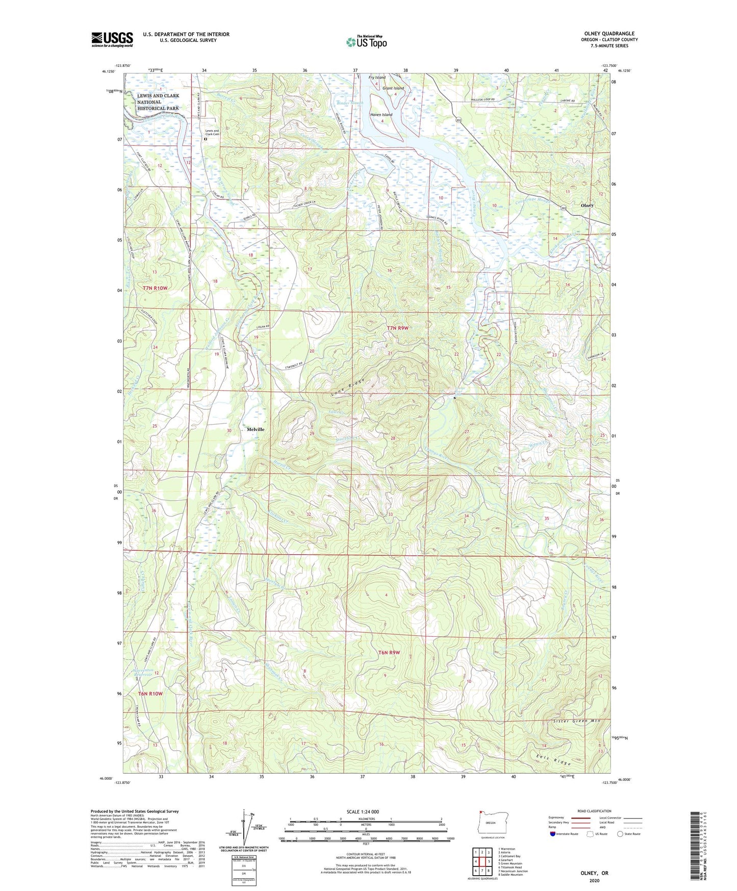
2024 topographic map quadrangle Olney in the state of Oregon. Scale: 1:24000. Based on the newly updated USGS 7.5' US Topo map series, this map is in the following counties: Clatsop. The map contains contour data, water features, and other items you are used to seeing on USGS maps, but also has updated roads and other features. This is the next generation of topographic maps. Printed on high-quality waterproof paper with UV fade-resistant inks.
Quads adjacent to this one:
West: Gearhart
Northwest: Warrenton
North: Astoria
Northeast: Cathlamet Bay
East: Green Mountain
Southeast: Saddle Mountain
South: Necanicum Junction
Southwest: Tillamook Head
This map covers the same area as the classic USGS quad with code o46123a7.
Contains the following named places: Battle Creek Slough, Bayney Creek, Binder Slough, Brower Creek, C 2 Lumber Camp, Carlson Farms, Casey Post Office, Casey Slough, Chadwell, Chadwell Post Office, Chadwell School, Cooperage Slough, Eels Ridge, Grant Island, Haven Island, Heckard Creek, Hortill Creek, Johnson Creek, Johnson Slough, Klaskanine River, Klickitat Creek, Laws Creek, Lewis and Clark Cemetery, Lewis and Clark River Boat Ramp, Lone Ridge, Loowit Creek, Melville, Melville Post Office, Moosmoos Creek, Olney, Olney Bridge Boat Ramp, Olney Post Office, Ostman Farm, Pearse Creek, Peterson Slough, Shweeash Creek, Sister Green Mountain, Speelyai Creek, Stavebolt Creek, Stavebolt Landing, Tucker Creek, Tucker Slough, Walford Johnson Creek, Warrenton Reservoir, Wawa Creek, Wise Post Office, Youngs River Falls, Youngs River Falls School, Youngs River Lewis and Clark Water District Water Treatment Plant