MyTopo
Cedar Creek Oregon US Topo Map
Couldn't load pickup availability
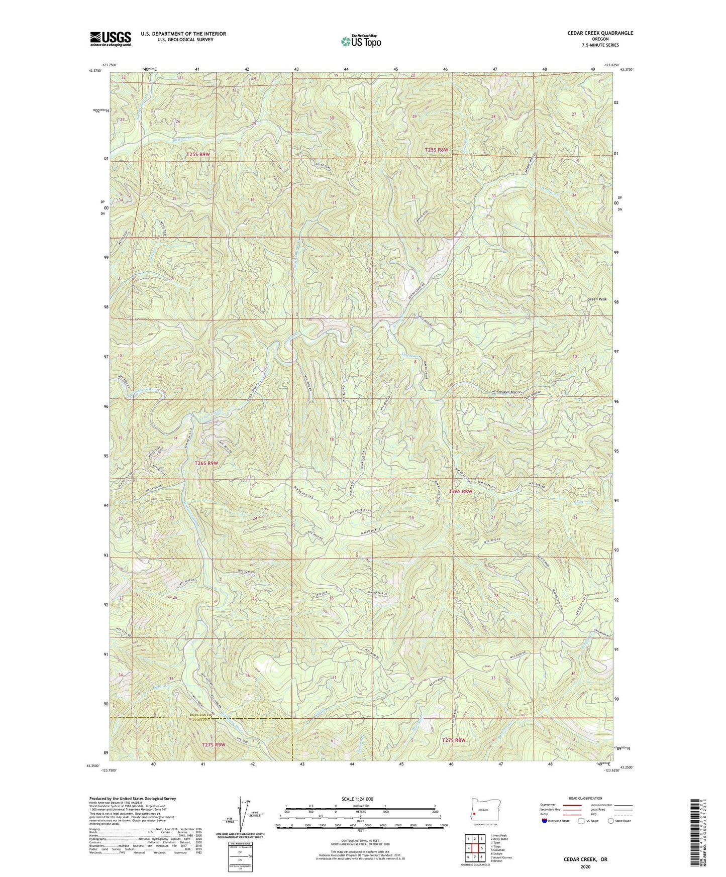
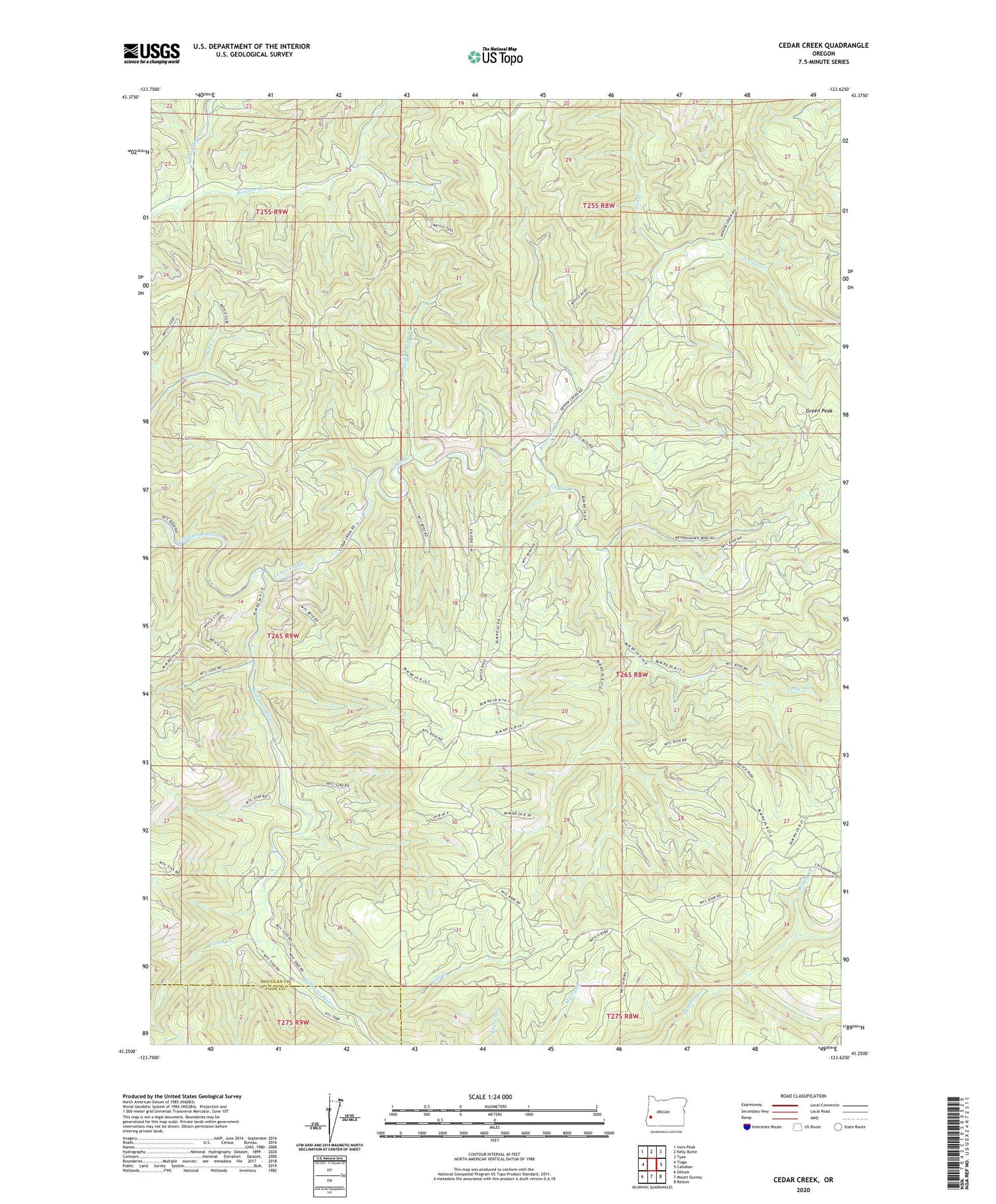
2020 topographic map quadrangle Cedar Creek in the state of Oregon. Scale: 1:24000. Based on the newly updated USGS 7.5' US Topo map series, this map is in the following counties: Douglas, Coos. The map contains contour data, water features, and other items you are used to seeing on USGS maps, but also has updated roads and other features. This is the next generation of topographic maps. Printed on high-quality waterproof paper with UV fade-resistant inks.
Quads adjacent to this one:
West: Tioga
Northwest: Ivers Peak
North: Kelly Butte
Northeast: Tyee
East: Callahan
Southeast: Reston
South: Mount Gurney
Southwest: Sitkum
Contains the following named places: Arrow Creek, Cabin Creek, Cedar Creek, Fall Creek, Gods Thumb Creek, Green Peak, North Fork Bottom Creek, Renfro Creek, Sow Creek, Woods Camp