MyTopo
Tyee Oregon US Topo Map
Couldn't load pickup availability
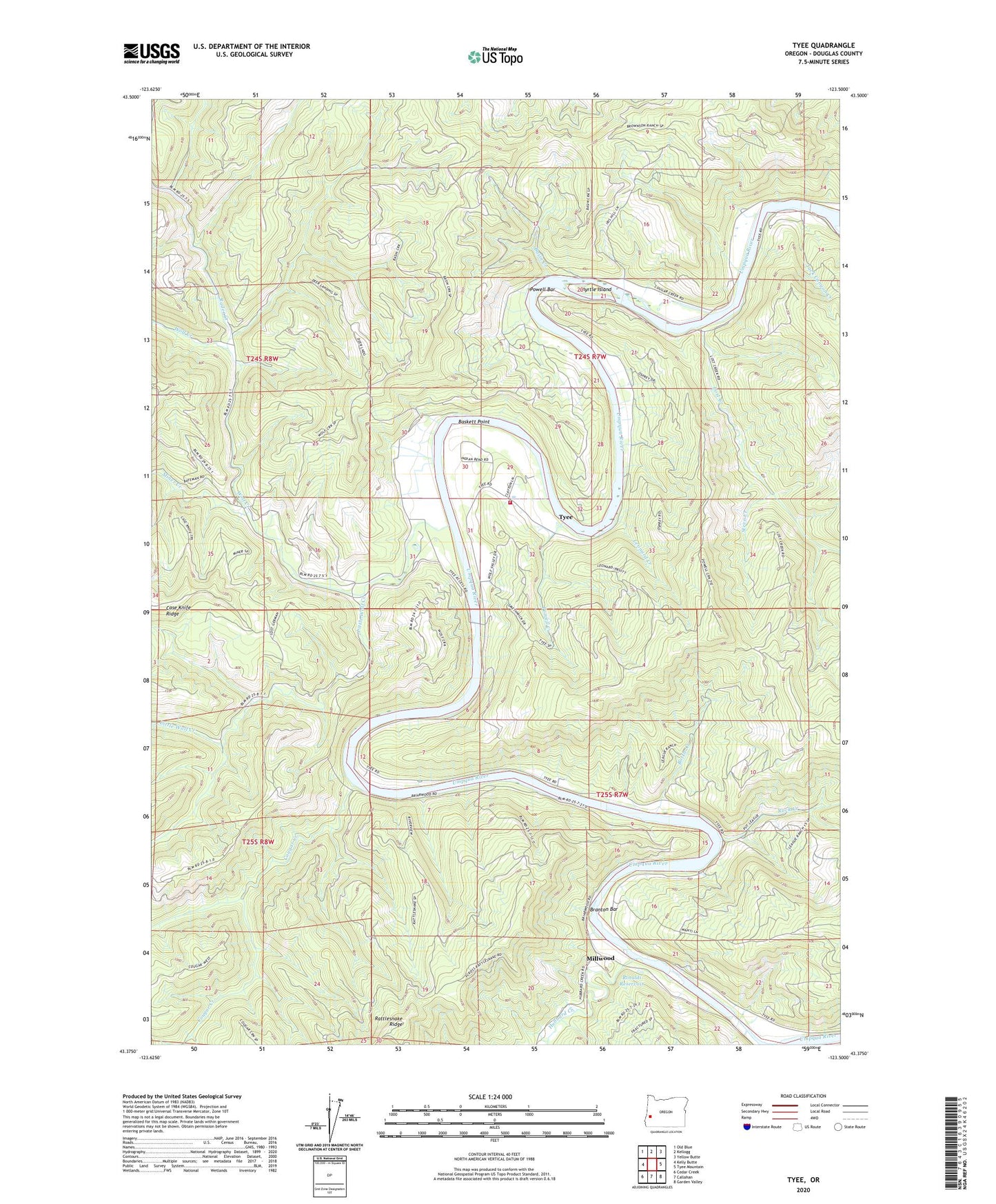
2023 topographic map quadrangle Tyee in the state of Oregon. Scale: 1:24000. Based on the newly updated USGS 7.5' US Topo map series, this map is in the following counties: Douglas. The map contains contour data, water features, and other items you are used to seeing on USGS maps, but also has updated roads and other features. This is the next generation of topographic maps. Printed on high-quality waterproof paper with UV fade-resistant inks.
Quads adjacent to this one:
West: Kelly Butte
Northwest: Old Blue
North: Kellogg
Northeast: Yellow Butte
East: Tyee Mountain
Southeast: Garden Valley
South: Callahan
Southwest: Cedar Creek
This map covers the same area as the classic USGS quad with code o43123d5.
Contains the following named places: Basin Creek, Baskett Point, Beaver Pond, Bottle Creek, Branton Bar, Cougar Creek, Hubbard Creek, Jack Canyon Creek, James Wood County Park Boat Ramp, James Wood Park, Kellogg Rural Fire District Station 2, Leonard Creek, Little Wolf Creek, Lost Creek, Mack Brown Park, Millwood, Millwood Post Office, Miner Creek, Myrtle Island, Osprey Boat Ramp, Powell Bar, Powell Creek, Rader Creek, Rattlesnake Ridge, Rinaldi Reservoir, Rock Creek, Steve Creek, Tyee, Tyee Camp, Tyee Post Office, Wolf Creek, ZIP Code: 97486