MyTopo
Sitkum Oregon US Topo Map
Couldn't load pickup availability
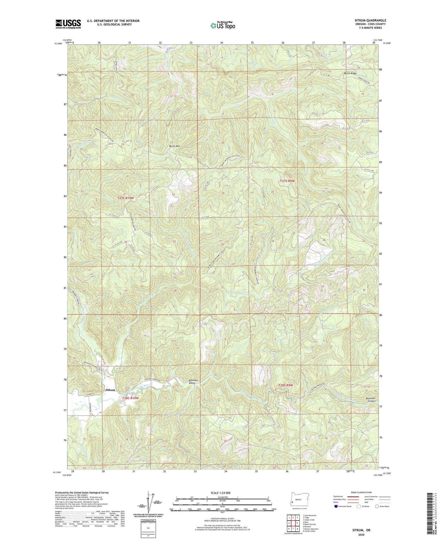
2023 topographic map quadrangle Sitkum in the state of Oregon. Scale: 1:24000. Based on the newly updated USGS 7.5' US Topo map series, this map is in the following counties: Coos. The map contains contour data, water features, and other items you are used to seeing on USGS maps, but also has updated roads and other features. This is the next generation of topographic maps. Printed on high-quality waterproof paper with UV fade-resistant inks.
Quads adjacent to this one:
West: Dora
Northwest: Coos Mountain
North: Tioga
Northeast: Cedar Creek
East: Mount Gurney
Southeast: Camas Valley
South: Kenyon Mountain
Southwest: Remote
This map covers the same area as the classic USGS quad with code o43123b7.
Contains the following named places: Brummit Creek, Burnt Mountain, Burnt Ridge, Camas Creek, Canyon Creek, Dead Horse Creek, East Fork Brummit Creek, Judge Hamilton County Park, Lost Creek, Maria C Jackson State Park, Middle Fork Brummit Creek, Sitkum, Sitkum Post Office, Skeeter Camp, West Fork Brummit Creek