MyTopo
Tioga Oregon US Topo Map
Couldn't load pickup availability
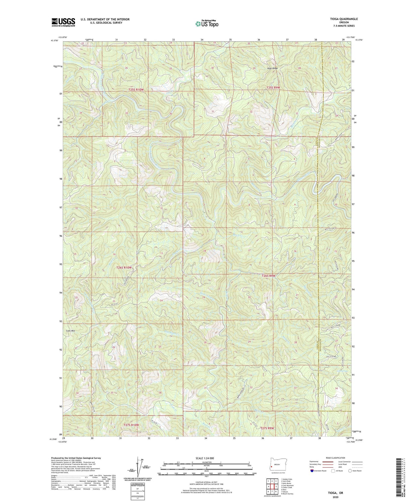
2023 topographic map quadrangle Tioga in the state of Oregon. Scale: 1:24000. Based on the newly updated USGS 7.5' US Topo map series, this map is in the following counties: Coos, Douglas. The map contains contour data, water features, and other items you are used to seeing on USGS maps, but also has updated roads and other features. This is the next generation of topographic maps. Printed on high-quality waterproof paper with UV fade-resistant inks.
Quads adjacent to this one:
West: Coos Mountain
Northwest: Golden Falls
North: Ivers Peak
Northeast: Kelly Butte
East: Cedar Creek
Southeast: Mount Gurney
South: Sitkum
Southwest: Dora
This map covers the same area as the classic USGS quad with code o43123c7.
Contains the following named places: Bench Creek, Bottom Creek, Buck Creek, Burnt Creek, Coal Creek, Cold Springs, Fall Creek, Farrin Camp, Farrin Creek, Hatcher Creek, Hog Ranch Creek, Mink Creek, Old Tioga Camp, Shotgun Creek, Skip Creek, Susan Creek, Tioga, Tioga Creek, Tioga Guard Station, Water Tank Creek, Williams River