MyTopo
Chapman Oregon US Topo Map
Couldn't load pickup availability
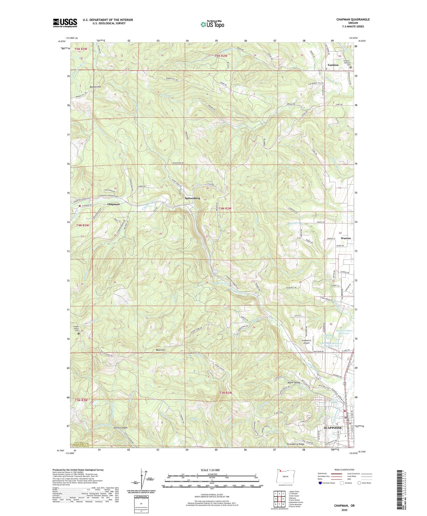
2023 topographic map quadrangle Chapman in the state of Oregon. Scale: 1:24000. Based on the newly updated USGS 7.5' US Topo map series, this map is in the following counties: Columbia, Washington. The map contains contour data, water features, and other items you are used to seeing on USGS maps, but also has updated roads and other features. This is the next generation of topographic maps. Printed on high-quality waterproof paper with UV fade-resistant inks.
Quads adjacent to this one:
West: Bacona
Northwest: Baker Point
North: Trenholm
Northeast: Deer Island
East: Saint Helens
Southeast: Sauvie Island
South: Dixie Mountain
Southwest: Meacham Corner
This map covers the same area as the classic USGS quad with code o45122g8.
Contains the following named places: Alder Creek, Apple Valley, Bald Hill, Bonnie Falls, Brush Creek, Cedar Creek, Chapman, Chapman Post Office, Columbia County Rider Chinook Plaza Park and Ride, Columbia County Rider Park and Ride, Cox Creek, Deep Creek, Dooly Creek, Fall Creek, Grabhorn's Airport, Heinen Pond, James O Fisher Dam, James O Fisher Reservoir, Lizzie Creek, McLafferty Creek, Old Yankton Cemetery, Petersen Elementary School, Pisgah Home Cemetery, Ruley, Saint Helens Arthur Academy, Saint Helens Division, Salmon Creek, Scappoose, Scappoose City Hall, Scappoose Division, Scappoose Middle School, Scappoose Municipal Court, Scappoose Police Department, Scappoose Post Office, Scappoose Public Library, Scappoose Rural Fire Protection District, Scappoose Rural Fire Protection District Chapman, Sherman Reservoir, Sherman Reservoir Number Two, Sly Creek, Spitzenberg, Strawberry Ridge, Warren Census Designated Place, Watts House Pioneer Museum, Woods Pond, Yankton, Yankton - Hillcrest Cemetery, Yankton Post Office, ZIP Codes: 97053, 97056