MyTopo
Meacham Corner Oregon US Topo Map
Couldn't load pickup availability
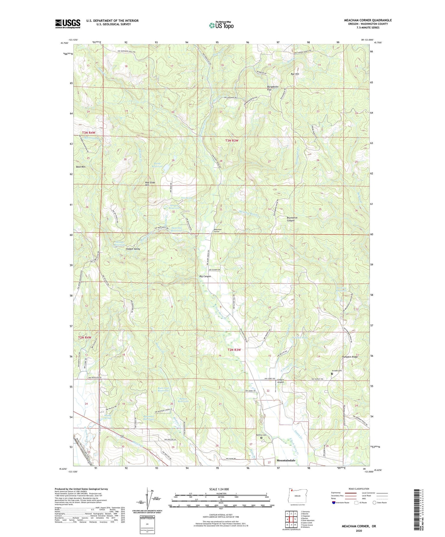
2024 topographic map quadrangle Meacham Corner in the state of Oregon. Scale: 1:24000. Based on the newly updated USGS 7.5' US Topo map series, this map is in the following counties: Washington. The map contains contour data, water features, and other items you are used to seeing on USGS maps, but also has updated roads and other features. This is the next generation of topographic maps. Printed on high-quality waterproof paper with UV fade-resistant inks.
Quads adjacent to this one:
West: Buxton
Northwest: Vernonia
North: Bacona
Northeast: Chapman
East: Dixie Mountain
Southeast: Hillsboro
South: Forest Grove
Southwest: Gales Creek
This map covers the same area as the classic USGS quad with code o45123f1.
Contains the following named places: Arcade Cemetery, Bald Mountain, Banks Water Treatment Facility, Bateman Reservoir, Big Canyon, Buck Mountain Ranch, Bump Reservoir, Burgdorfer Flat, Camp Mountaindale, Covey Ridge Vineyard, Dam Site Reservoir, Denny Creek, Dixie, Dixie Post Office, East Gumm Creek, Eccles Mill, Fern Spring, Gilbert Airport, Grebe Creek, Gumm Creek, Hidden Valley, Horning Reservoir, Krueger's Tree Farms, Little Bend Park, Meacham Corner, Meadow Brook, Mountaindale Church, Mountaindale School, Murtaugh Creek, Ornoname 22 Dam, Panther Creek, Plentywater Creek, Pumpkin Ridge, Raffety Cemetery, Rails End Reservoir, Rebart Reservoir, Red Slide Hill, Rock Creek, Rye Hill, Shipley Springs, Silver Winds Farm, Sky Ranch, Smoke Ranch, Snooseville Corner, Spaniol Reservoir, Sunago Reservoir, Washington Grange Hall, Welches Pond, Whiskey Creek, White Water Farms, ZIP Codes: 97106, 97133