MyTopo
Dixie Mountain Oregon US Topo Map
Couldn't load pickup availability
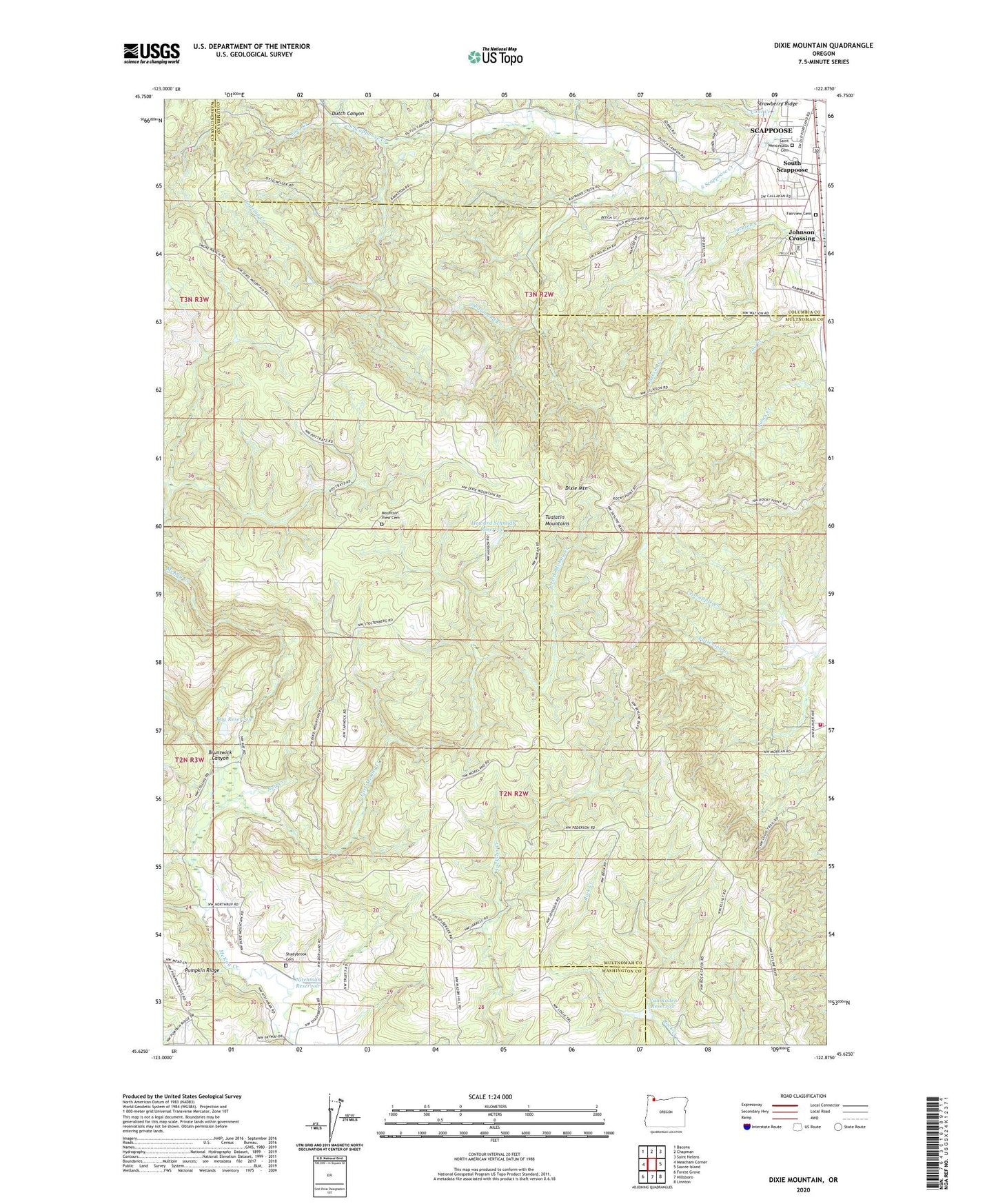
2023 topographic map quadrangle Dixie Mountain in the state of Oregon. Scale: 1:24000. Based on the newly updated USGS 7.5' US Topo map series, this map is in the following counties: Washington, Multnomah, Columbia. The map contains contour data, water features, and other items you are used to seeing on USGS maps, but also has updated roads and other features. This is the next generation of topographic maps. Printed on high-quality waterproof paper with UV fade-resistant inks.
Quads adjacent to this one:
West: Meacham Corner
Northwest: Bacona
North: Chapman
Northeast: Saint Helens
East: Sauvie Island
Southeast: Linnton
South: Hillsboro
Southwest: Forest Grove
This map covers the same area as the classic USGS quad with code o45122f8.
Contains the following named places: Brunswick Canyon, Coal Creek, Crabapple Creek, Dixie Mountain, Dixie Ranch, Dutch Canyon, East Fork McKay Creek, Fairview Cemetery, Gourlay Creek, Grace Lutheran Church, Howard Schmidt Dam, Howard Schmidt Reservoir, John Place Reservoir, Johnson Crossing, Kay Dam, Kay Reservoir, Lazy Creek, Mason Hill Park, Mountain View Cemetery, Mud Creek, Neil Creek, Nitchman Reservoir, North Plains Division, Patterson Creek, Raymond Creek, Saint Wenceslaus Catholic Church, Saint Wenceslaus Cemetery, Salt Creek, Scappoose Rural Fire District Holbrook Station, Shadybrook, Shadybrook Cemetery, Sky Ranch, South Scappoose, Tualatin Mountains, Van Raden Dam, Van Raden Reservoir, Wallace School, Wolf Creek