MyTopo
Cherryville Oregon US Topo Map
Couldn't load pickup availability
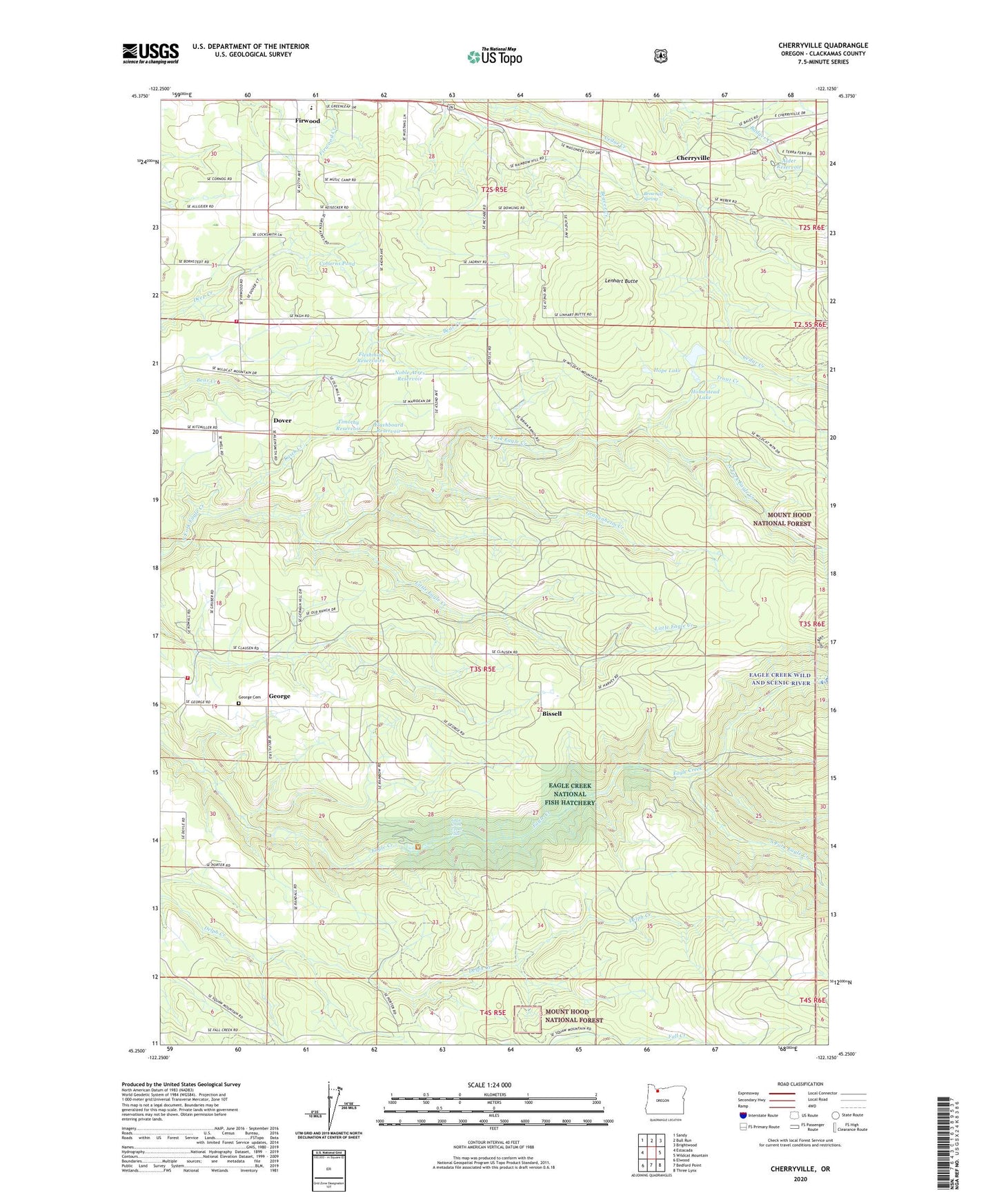
2020 topographic map quadrangle Cherryville in the state of Oregon. Scale: 1:24000. Based on the newly updated USGS 7.5' US Topo map series, this map is in the following counties: Clackamas. The map contains contour data, water features, and other items you are used to seeing on USGS maps, but also has updated roads and other features. This is the next generation of topographic maps. Printed on high-quality waterproof paper with UV fade-resistant inks.
Quads adjacent to this one:
West: Estacada
Northwest: Sandy
North: Bull Run
Northeast: Brightwood
East: Wildcat Mountain
Southeast: Three Lynx
South: Bedford Point
Southwest: Elwood
Contains the following named places: Alder Reservoir, Bissell, Bissell Post Office, Brownell Spring, Cherryville, Cherryville Cemetery, Cherryville Post Office, Coburns Pond, Dover, Dover Community Church, Dover Post Office, Eagle Creek National Fish Hatchery, Eagle Creek Upper Falls, Estacada Rural Fire District George Station, Firwood Elementary School, Flashboard Reservoir, Fleshman Reservoirs, Gabenheim Creek, George, George Cemetery, George Community Church, George Post Office, Homestead Lake, Hope Lake, Kasch Creek, Lenhart Butte, Little Eagle Creek, Noble Acres Reservoir, Porter, Porter School, Sandy Fire Protection District Station 74, South Fork Eagle Creek, Timothy Reservoir, Todd Reservoir, Trout Creek