MyTopo
Chicken Hills Oregon US Topo Map
Couldn't load pickup availability
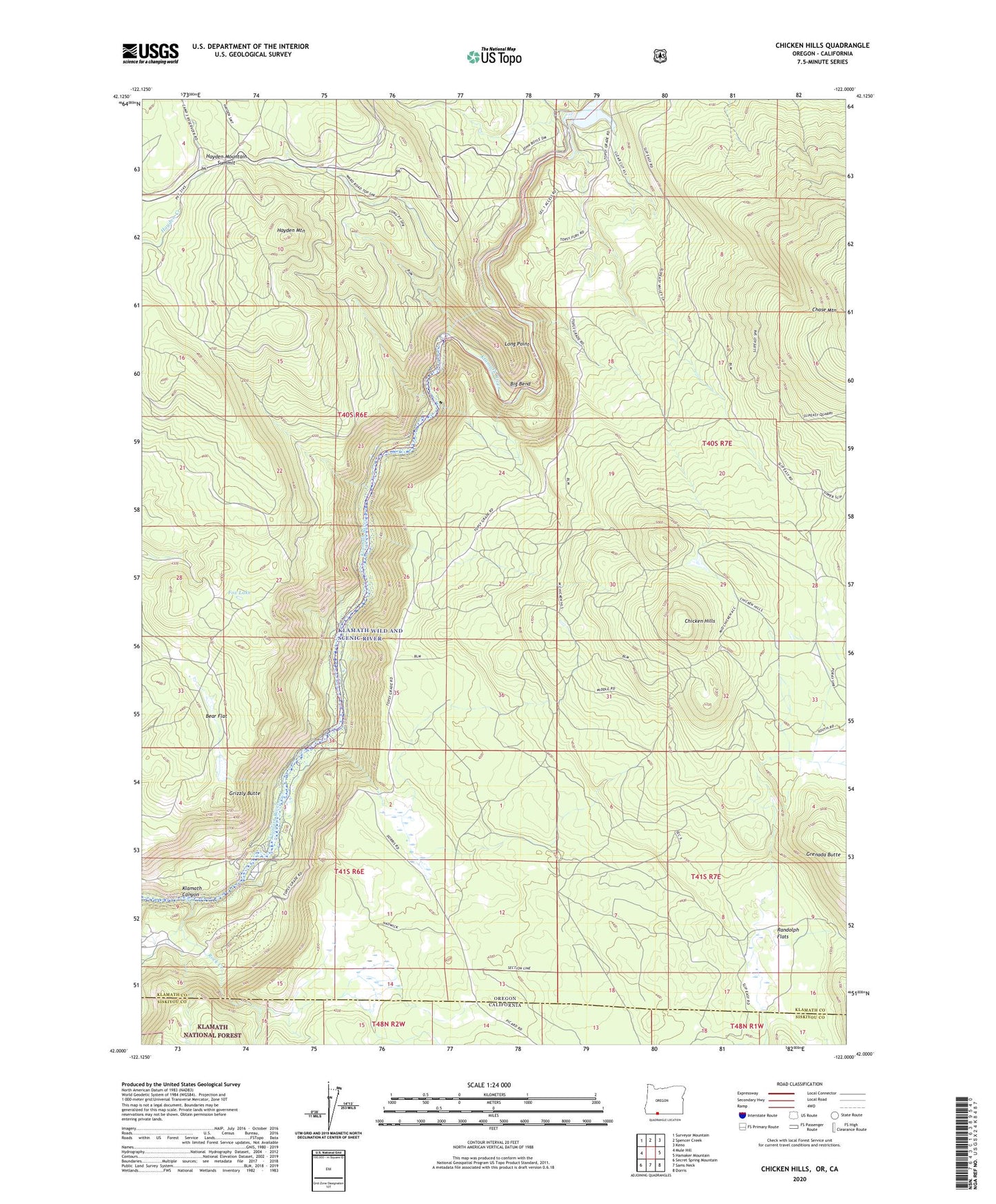
2020 topographic map quadrangle Chicken Hills in the state of Oregon. Scale: 1:24000. Based on the newly updated USGS 7.5' US Topo map series, this map is in the following counties: Klamath, Siskiyou. The map contains contour data, water features, and other items you are used to seeing on USGS maps, but also has updated roads and other features. This is the next generation of topographic maps. Printed on high-quality waterproof paper with UV fade-resistant inks.
Quads adjacent to this one:
West: Mule Hill
Northwest: Surveyor Mountain
North: Spencer Creek
Northeast: Keno
East: Hamaker Mountain
Southeast: Dorris
South: Sams Neck
Southwest: Secret Spring Mountain
Contains the following named places: Bear Flat, Big Bend, Chicken Hills, Fox Lake, Grenada Butte, Grizzly Butte, Hayden Mountain, Hayden Mountain Summit, John C Boyle Dam, John C Boyle Power Plant, Klamath Canyon, Long Point, Penny Spring Guard Station, Randolph Flats, Rock Creek, Topsy Boat Ramp, Topsy Post Office, Topsy Recreation Site, Wampus Post Office