MyTopo
Secret Spring Mountain California US Topo Map
Couldn't load pickup availability
Also explore the Secret Spring Mountain Forest Service Topo of this same quad for updated USFS data
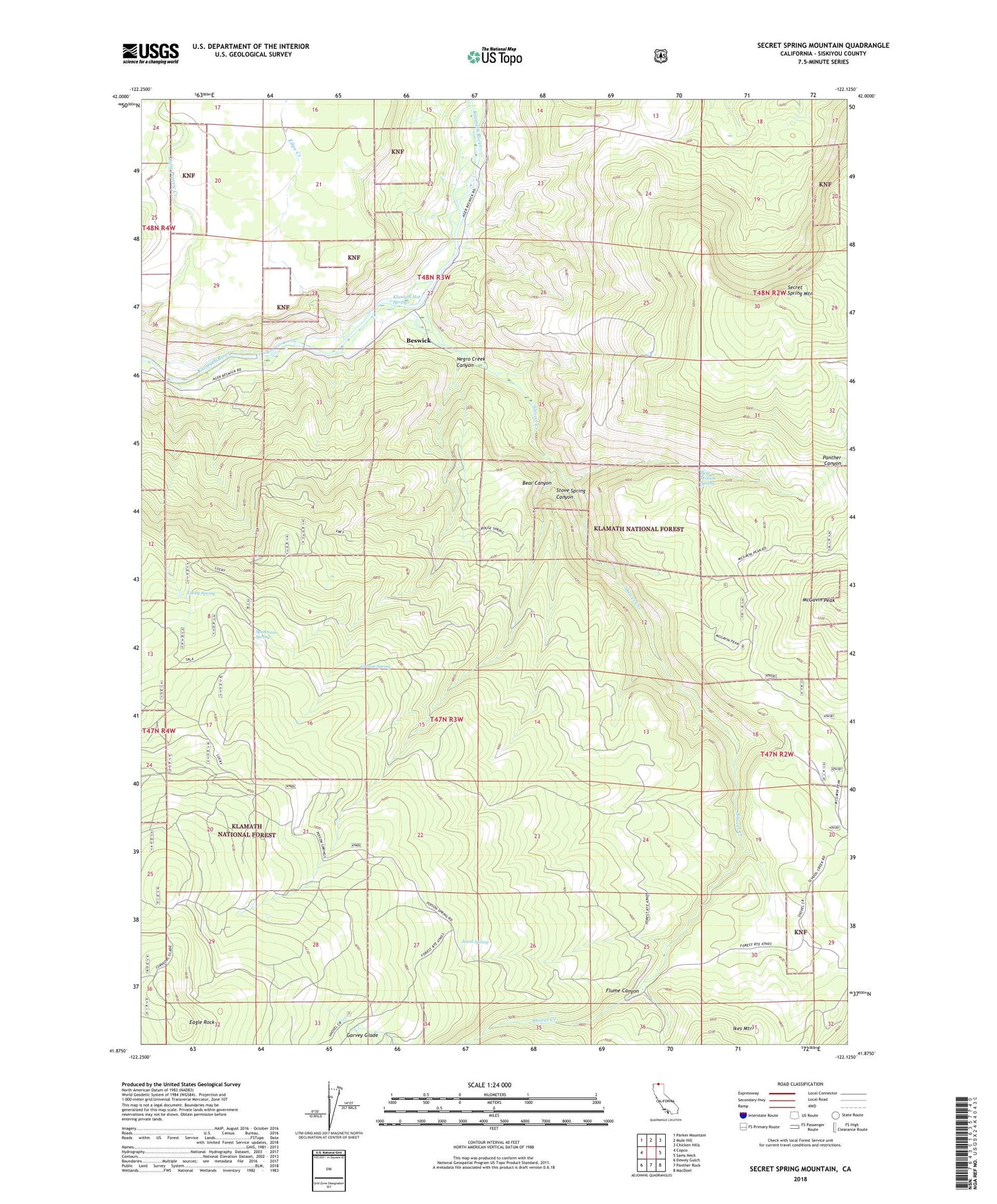
2022 topographic map quadrangle Secret Spring Mountain in the state of California. Scale: 1:24000. Based on the newly updated USGS 7.5' US Topo map series, this map is in the following counties: Siskiyou. The map contains contour data, water features, and other items you are used to seeing on USGS maps, but also has updated roads and other features. This is the next generation of topographic maps. Printed on high-quality waterproof paper with UV fade-resistant inks.
Quads adjacent to this one:
West: Copco
Northwest: Parker Mountain
North: Mule Hill
Northeast: Chicken Hills
East: Sams Neck
Southeast: MacDoel
South: Panther Rock
Southwest: Dewey Gulch
This map covers the same area as the classic USGS quad with code o41122h2.
Contains the following named places: Bear Canyon, Bear Canyon Campground, Bear Canyon Ranger Station, Bear Wallow Spring, Beswick, Eagle Rock, Edge Creek, Flume Canyon, Grouse Spring, Hessig Ranch, Jewel Spring, Klamath Hot Springs, Lower Crossing, Lucky Spring, McGavin Peak, Negro Creek Canyon, Oak Grove School, Panther Canyon, Rock Creek, Secret Spring Mountain, Shovel Creek, Shovel Creek Guard Station, Spannaus Ranch, Spannaus Spring, Stove Spring Canyon, Upper Crossing