MyTopo
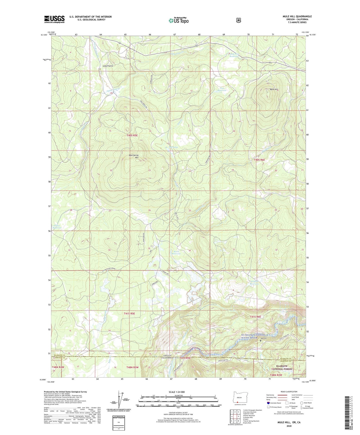
Mule Hill Oregon US Topo Map
Couldn't load pickup availability
Also explore the Mule Hill Forest Service Topo of this same quad for updated USFS data
2023 topographic map quadrangle Mule Hill in the state of Oregon. Scale: 1:24000. Based on the newly updated USGS 7.5' US Topo map series, this map is in the following counties: Klamath, Siskiyou. The map contains contour data, water features, and other items you are used to seeing on USGS maps, but also has updated roads and other features. This is the next generation of topographic maps. Printed on high-quality waterproof paper with UV fade-resistant inks.
Quads adjacent to this one:
West: Parker Mountain
Northwest: Little Chinquapin Mountain
North: Surveyor Mountain
Northeast: Spencer Creek
East: Chicken Hills
Southeast: Sams Neck
South: Secret Spring Mountain
Southwest: Copco
This map covers the same area as the classic USGS quad with code o42122a2.
Contains the following named places: Camp Four, Camp Four Creek, Camp Four Reservoir, Forty-one Ranch, Griffith Reservoir, Hayden Creek, Long Prairie, Mud Spring, Mud Spring Mountain, Mule Hill, Pokegama, Pokegama Post Office, Potter Mill, Tom Creek, Tom Reservoir, Ward Reservoir, Way Cemetery