MyTopo
Circle Bar Oregon US Topo Map
Couldn't load pickup availability
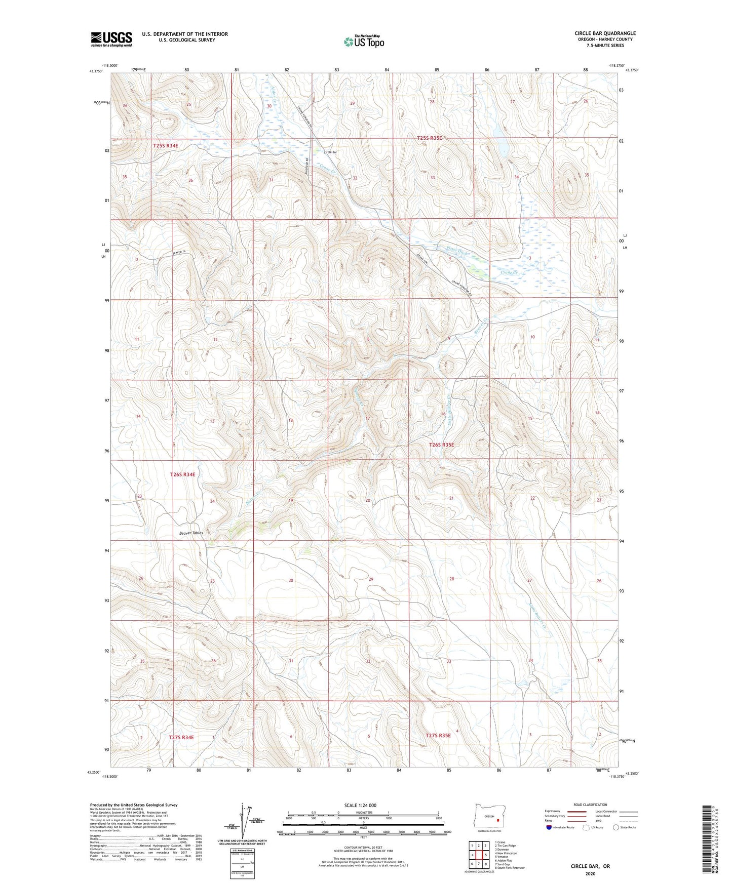
2023 topographic map quadrangle Circle Bar in the state of Oregon. Scale: 1:24000. Based on the newly updated USGS 7.5' US Topo map series, this map is in the following counties: Harney. The map contains contour data, water features, and other items you are used to seeing on USGS maps, but also has updated roads and other features. This is the next generation of topographic maps. Printed on high-quality waterproof paper with UV fade-resistant inks.
Quads adjacent to this one:
West: New Princeton
Northwest: Crane
North: Tin Can Ridge
Northeast: Dunnean
East: Venator
Southeast: South Fork Reservoir
South: Sand Gap
Southwest: Adobe Flat
This map covers the same area as the classic USGS quad with code o43118c4.
Contains the following named places: Alder Creek, Beaver Creek, Circle Bar, Circle Bar Ranch, Fister Ditch, Hamilton Ranch, Little Beaver Creek, Miller Ranch