MyTopo
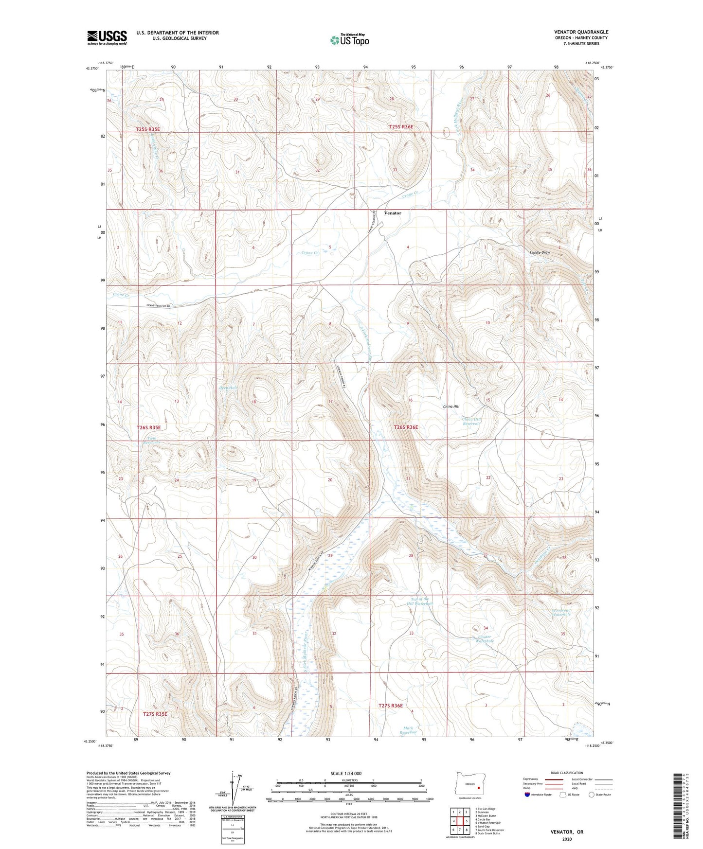
Venator Oregon US Topo Map
Couldn't load pickup availability
2023 topographic map quadrangle Venator in the state of Oregon. Scale: 1:24000. Based on the newly updated USGS 7.5' US Topo map series, this map is in the following counties: Harney. The map contains contour data, water features, and other items you are used to seeing on USGS maps, but also has updated roads and other features. This is the next generation of topographic maps. Printed on high-quality waterproof paper with UV fade-resistant inks.
Quads adjacent to this one:
West: Circle Bar
Northwest: Tin Can Ridge
North: Dunnean
Northeast: McEwen Butte
East: Venator Reservoir
Southeast: Duck Creek Butte
South: South Fork Reservoir
Southwest: Sand Gap
This map covers the same area as the classic USGS quad with code o43118c3.
Contains the following named places: China Hill, China Hill Reservoir, Crane Creek, Deadman Creek, Deep Hole, Floater Waterhole, Hughes Ranch, Little Crane Creek, Mark Reservoir, Pole Creek, Round Mountain Reservoir, Saddle Draw, Top of the Hill Waterhole, Twin Reservoir, Venator, Venator Post Office, Venator Ranch, Woodroad Waterhole