MyTopo
Clarno Oregon US Topo Map
Couldn't load pickup availability
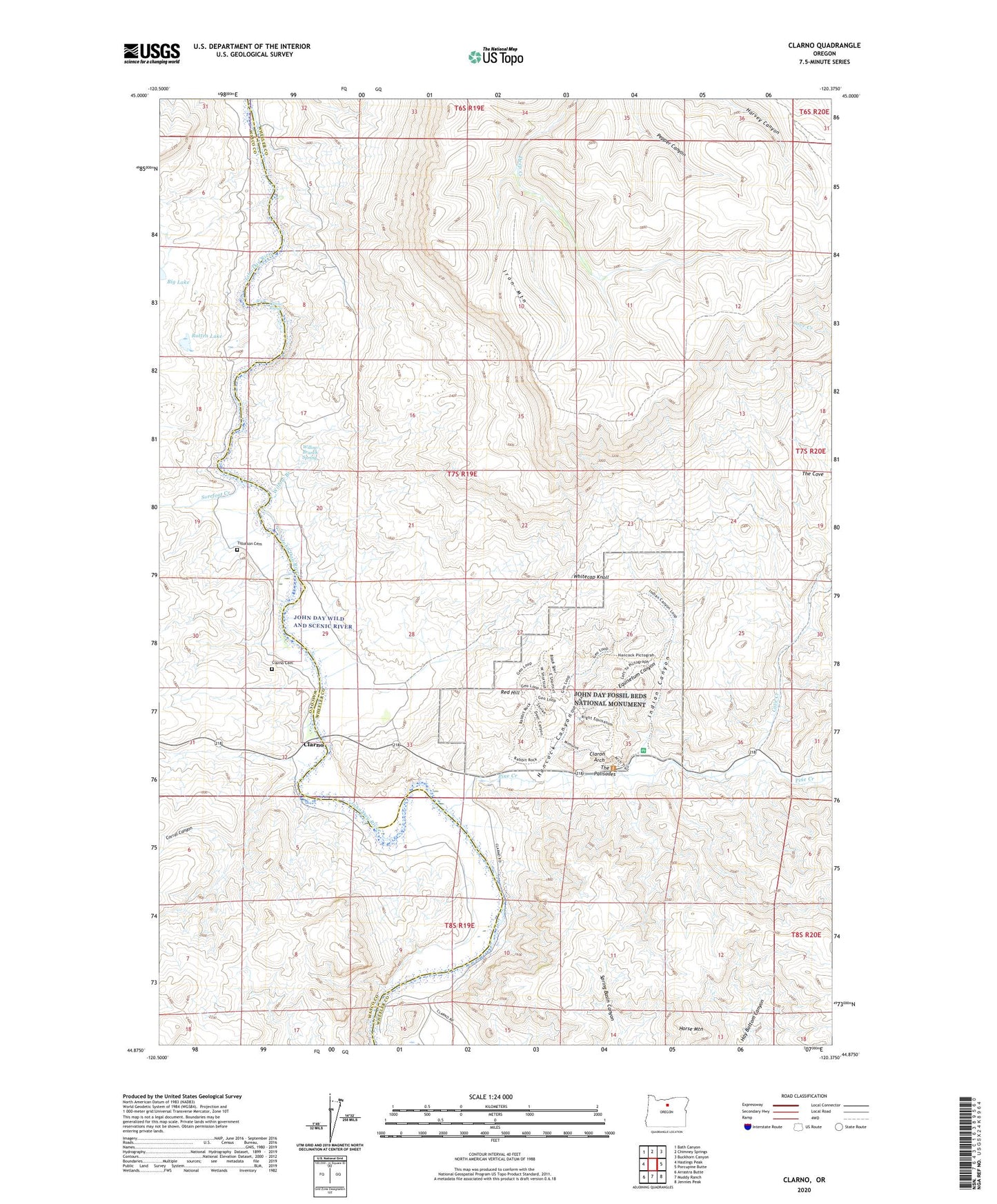
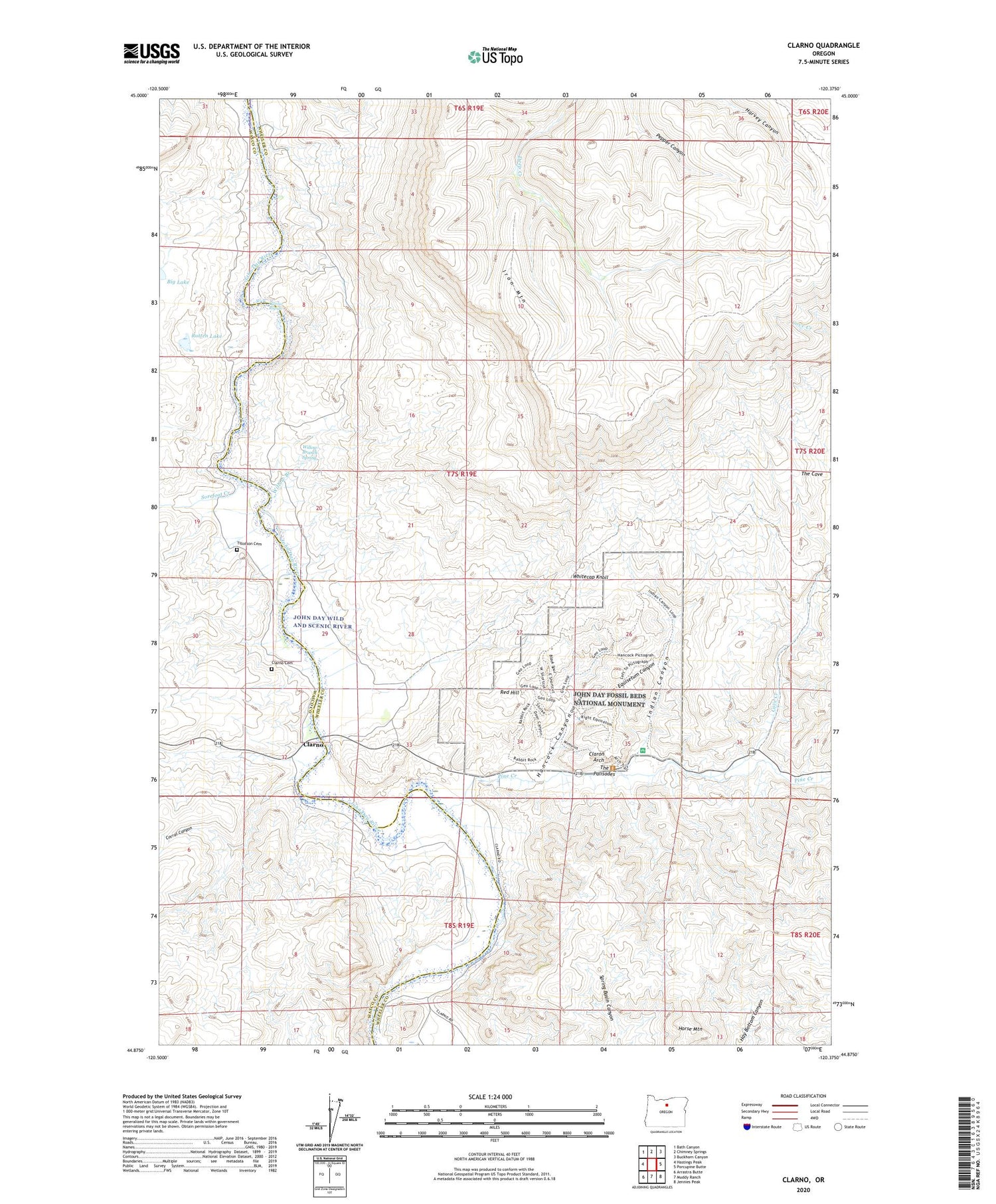
2020 topographic map quadrangle Clarno in the state of Oregon. Scale: 1:24000. Based on the newly updated USGS 7.5' US Topo map series, this map is in the following counties: Wheeler, Wasco. The map contains contour data, water features, and other items you are used to seeing on USGS maps, but also has updated roads and other features. This is the next generation of topographic maps. Printed on high-quality waterproof paper with UV fade-resistant inks.
Quads adjacent to this one:
West: Hastings Peak
Northwest: Bath Canyon
North: Chimney Springs
Northeast: Buckhorn Canyon
East: Porcupine Butte
Southeast: Jennies Peak
South: Muddy Ranch
Southwest: Arrastra Butte
Contains the following named places: Black Spur, Camp Hancock, Clarno, Clarno Cemetery, Clarno Post Office, Clarno Rapids, Clarno State Recreation Site Boat Launch, Claron Arch, Corral Canyon, Cove Creek, Crown Rock, Crown Rock Post Office, Equisetum Canyon, Francisville Post Office, Hancock Canyon, Horse Mountain, Huntley Post Office, Indian Canyon, Iron Mountain, Lower Pine Creek School, Pine Creek, Red Hill, Rotten Lake, Sorefoot Creek, The Palisades, Tillotson Cemetery, Whitecap Knoll, Willow Branch, Willow Branch Spring