MyTopo
Muddy Ranch Oregon US Topo Map
Couldn't load pickup availability
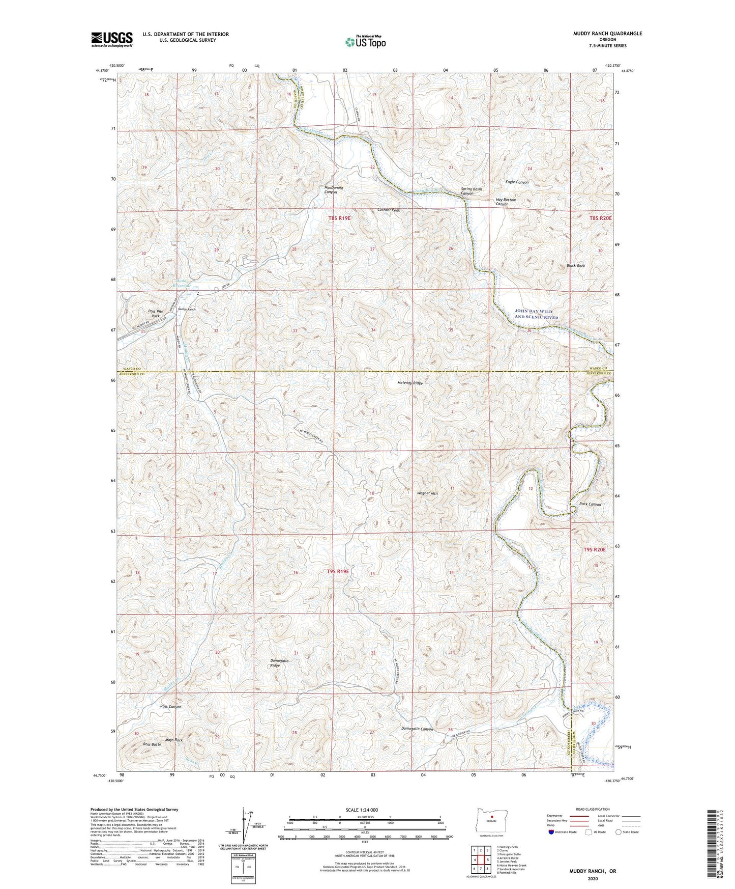
2024 topographic map quadrangle Muddy Ranch in the state of Oregon. Scale: 1:24000. Based on the newly updated USGS 7.5' US Topo map series, this map is in the following counties: Jefferson, Wasco, Wheeler. The map contains contour data, water features, and other items you are used to seeing on USGS maps, but also has updated roads and other features. This is the next generation of topographic maps. Printed on high-quality waterproof paper with UV fade-resistant inks.
Quads adjacent to this one:
West: Arrastra Butte
Northwest: Hastings Peak
North: Clarno
Northeast: Porcupine Butte
East: Jennies Peak
Southeast: Painted Hills
South: Sandrock Mountain
Southwest: Horse Heaven Creek
This map covers the same area as the classic USGS quad with code o44120g4.
Contains the following named places: Big Muddy Ranch Airport, Black Rock, Cherry Creek, Cherry Creek Post Office, Cherry Creek Ranch, Currant Creek, Currant Creek Dam, Currant Peak, Domogalla Canyon, Domogalla Ridge, Dry Creek, Eagle Canyon, Hay Bottom Canyon, MacDonald Canyon, Mays Rock, Melendy Ridge, Muddy Creek, Muddy Ranch, Muddy Reservoir, Post Pile Rock, Rock Canyon, Rock Fort, Ross Butte, Ross Canyon, Ross Creek, Spring Basin Canyon, Spring Basin Wilderness, Wagner Mountain, Wagner Ranch