MyTopo
Cochran Oregon US Topo Map
Couldn't load pickup availability
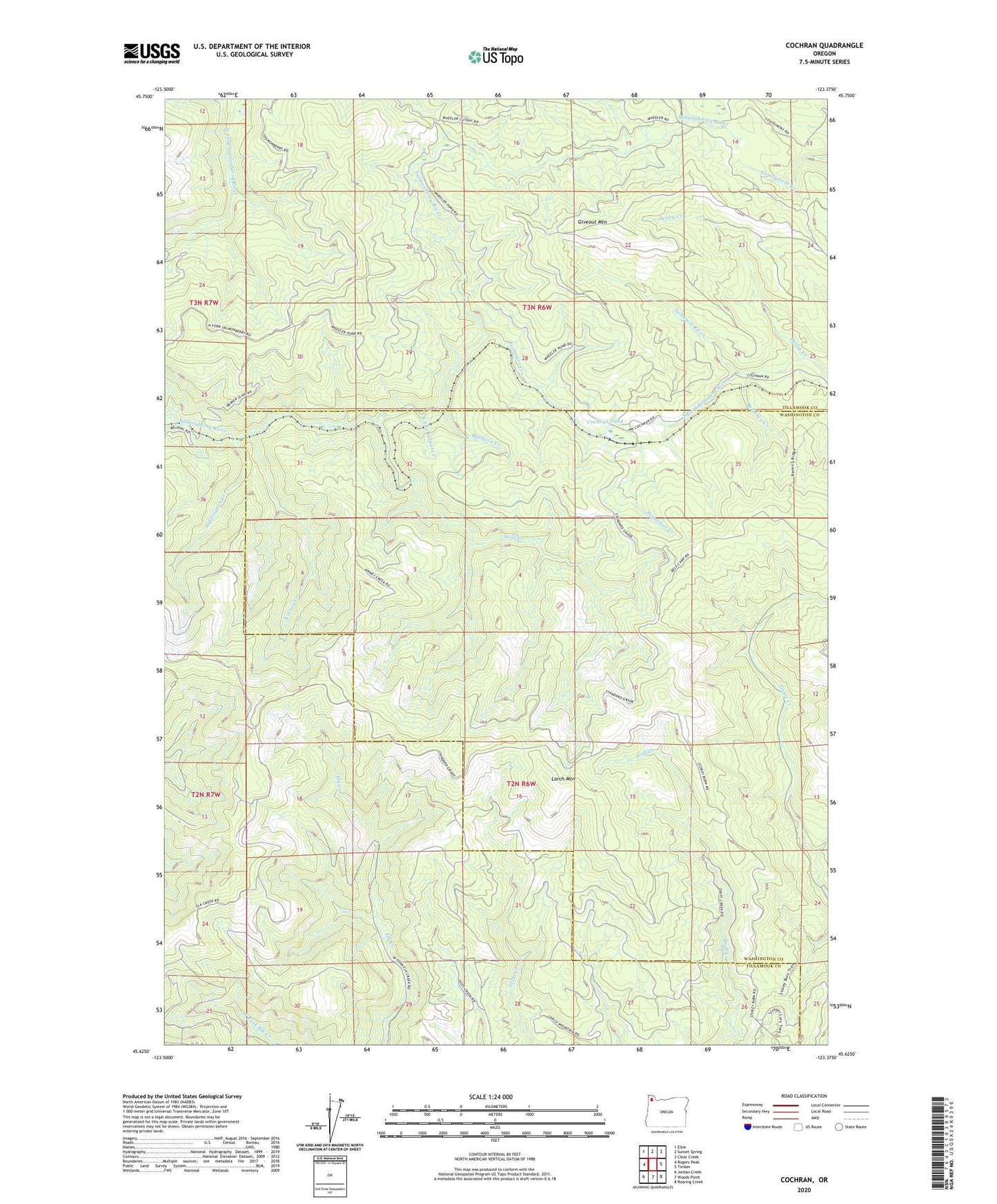
2020 topographic map quadrangle Cochran in the state of Oregon. Scale: 1:24000. Based on the newly updated USGS 7.5' US Topo map series, this map is in the following counties: Tillamook, Washington. The map contains contour data, water features, and other items you are used to seeing on USGS maps, but also has updated roads and other features. This is the next generation of topographic maps. Printed on high-quality waterproof paper with UV fade-resistant inks.
Quads adjacent to this one:
West: Rogers Peak
Northwest: Elsie
North: Sunset Spring
Northeast: Clear Creek
East: Timber
Southeast: Roaring Creek
South: Woods Point
Southwest: Jordan Creek
Contains the following named places: Baldwin Creek, Big Baldwin, Blue Lake Logging Company, Blue Lake Lookout, Cochran, Cochran Pond, Cochran Post Office, Derby Creek, Douty, Douty Post Office, Giveout Mountain, Hillburn, Kinney Creek, L H Timber Company, Larch Mountain, Little Baldwin Creek, Mayo, Pennoyer Creek, Reliance, Reliance Creek, Sappington Creek, South Fork Nehalem River, Wolf Creek