MyTopo
Timber Oregon US Topo Map
Couldn't load pickup availability
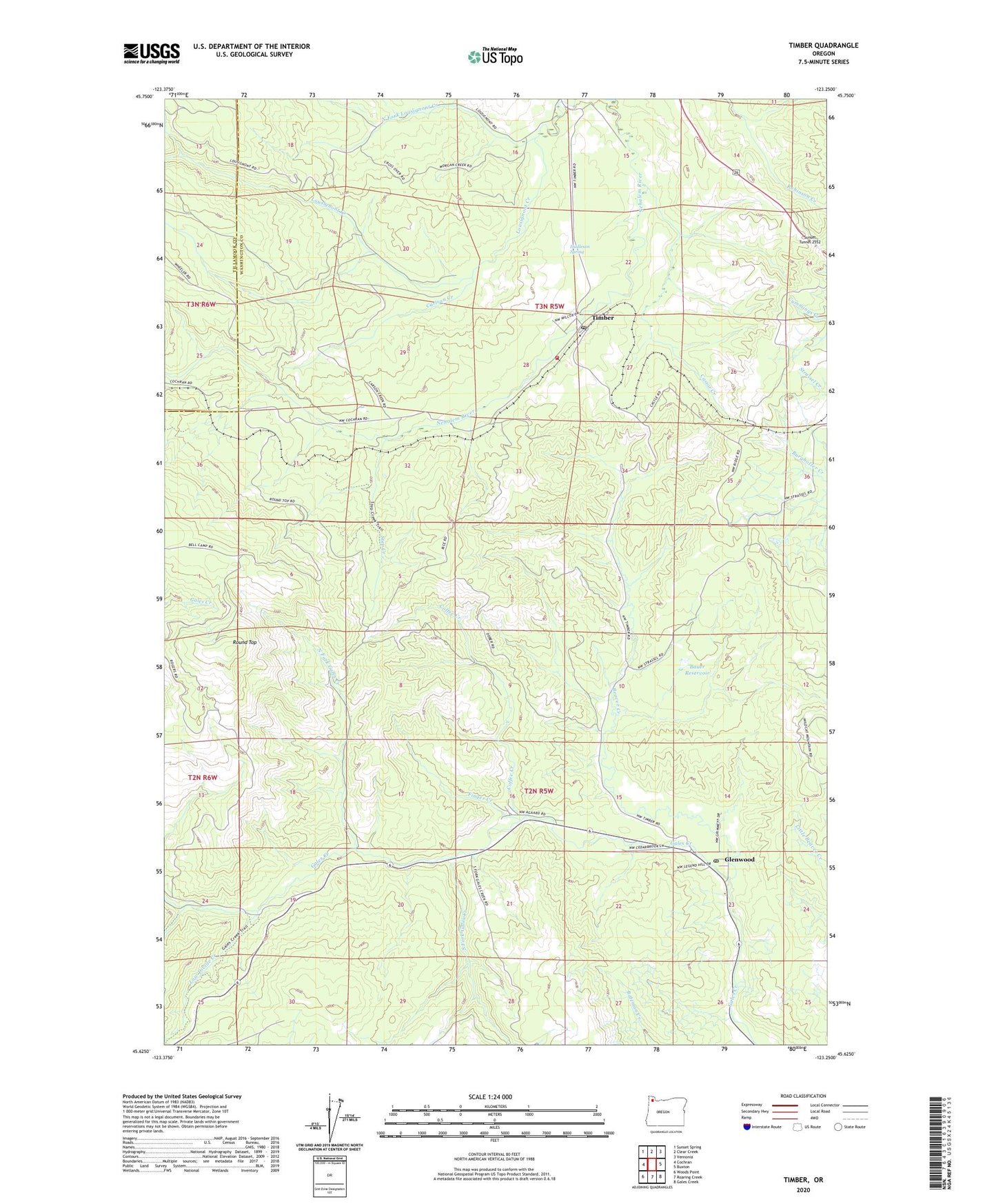
2023 topographic map quadrangle Timber in the state of Oregon. Scale: 1:24000. Based on the newly updated USGS 7.5' US Topo map series, this map is in the following counties: Washington, Tillamook. The map contains contour data, water features, and other items you are used to seeing on USGS maps, but also has updated roads and other features. This is the next generation of topographic maps. Printed on high-quality waterproof paper with UV fade-resistant inks.
Quads adjacent to this one:
West: Cochran
Northwest: Sunset Spring
North: Clear Creek
Northeast: Vernonia
East: Buxton
Southeast: Gales Creek
South: Roaring Creek
Southwest: Woods Point
This map covers the same area as the classic USGS quad with code o45123f3.
Contains the following named places: Banks Fire Protection District 13 Timber Station, Bauer Dam, Bauer Reservoir, Beaver Creek, Burnt Woods Post Office, Carlson Creek, Castor Creek, Coffee Creek, Consolidated Timber Company Camp, East Portland Lumber Company, Fernwood, Finger Creek, Fir Post Office, Gales Creek Campground, Gales Creek Childrens Camp, Glenwood, Glenwood Post Office, Grays Spur, Hudleson Spring, Hulbert, Low Divide Creek, North Fork Gales Creek, North Fork Lousignont Creek, Reeher CCC Camp, Reehers Camp, Round Top, South Fork Gales Creek, South Fork Industry Track, Step Creek, Sunset Tunnel 2552, Timber, Timber Post Office, Treen, Walcott, Walcott Tunnel, Wedeburg, Weist, Westimber, Westimber Post Office, ZIP Codes: 97117, 97144