MyTopo
Coleman Mountain Oregon US Topo Map
Couldn't load pickup availability
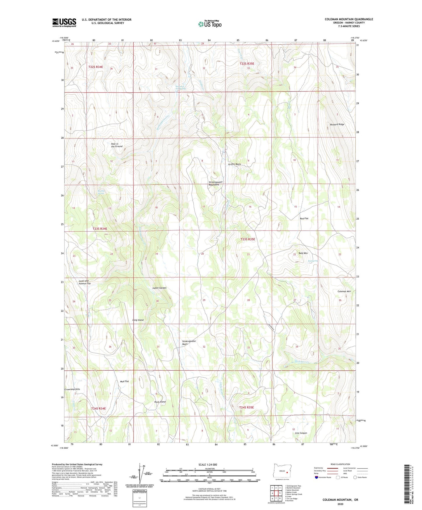
2020 topographic map quadrangle Coleman Mountain in the state of Oregon. Scale: 1:24000. Based on the newly updated USGS 7.5' US Topo map series, this map is in the following counties: Harney. The map contains contour data, water features, and other items you are used to seeing on USGS maps, but also has updated roads and other features. This is the next generation of topographic maps. Printed on high-quality waterproof paper with UV fade-resistant inks.
Quads adjacent to this one:
West: Mahon Creek
Northwest: Stinkingwater Pass
North: Bartlett Mountain
Northeast: Upton Mountain
East: Warm Springs Creek
Southeast: Dunnean
South: Tin Can Ridge
Southwest: Crane
Contains the following named places: Bald Mountain, Big Pines, Bootleg Spring, Buzzard Ridge, Coleman Mountain, Griffin Basin, Griffin Creek, Hog Creek, Hole in the Ground, Indian Garden, Jones and Ausmus Flat, Long Island, Lucas Cabin, Mountain Ash Springs, Mud Flat, Red Flat, Red Spring, Rock Island, Stinkingwater Basin