MyTopo
Mahon Creek Oregon US Topo Map
Couldn't load pickup availability
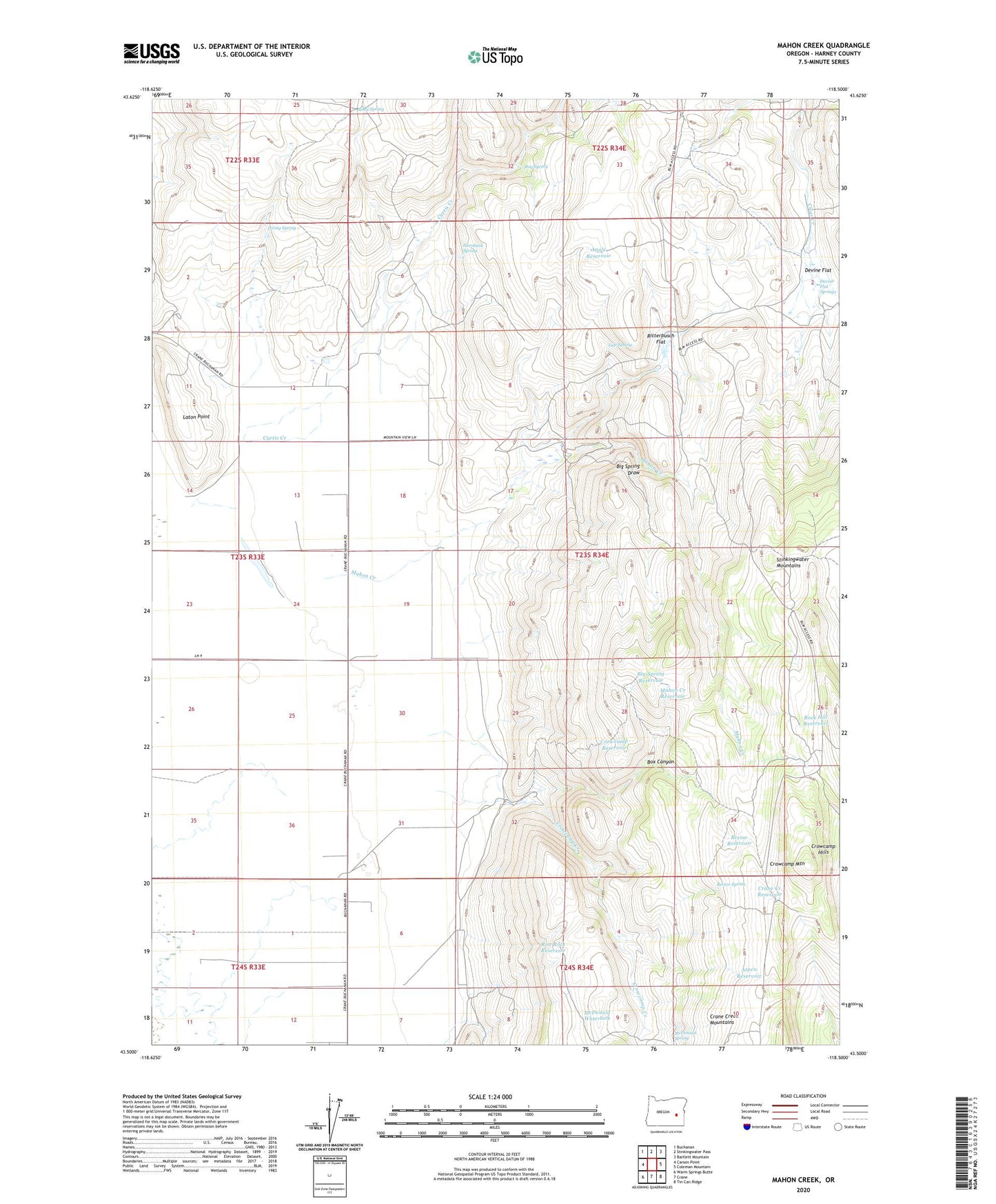
2024 topographic map quadrangle Mahon Creek in the state of Oregon. Scale: 1:24000. Based on the newly updated USGS 7.5' US Topo map series, this map is in the following counties: Harney. The map contains contour data, water features, and other items you are used to seeing on USGS maps, but also has updated roads and other features. This is the next generation of topographic maps. Printed on high-quality waterproof paper with UV fade-resistant inks.
Quads adjacent to this one:
West: Carson Point
Northwest: Buchanan
North: Stinkingwater Pass
Northeast: Bartlett Mountain
East: Coleman Mountain
Southeast: Tin Can Ridge
South: Crane
Southwest: Warm Springs Butte
This map covers the same area as the classic USGS quad with code o43118e5.
Contains the following named places: Angle Reservoir, Aspen Reservoir, Big Spring Draw, Big Spring Reservoir, Bog Spring, Box Canyon, Crane Creek Reservoir, Crowcamp Hills, Crowcamp Mountain, Crowcamp Reservoir, Curtis Creek, Devine Flat, Devine Flat Springs, Hornbeck Spring, Irving Spring, Laton Point, Mahon Creek, Mahon Creek Reservoir, McDonald Spring, McDonald Waterhole, Miller Brothers Ranch, Rector Reservoir, Rector Spring, Riley Spring, Rim Rock Reservoir, Ritterbusch Flat, Rock Hill Reservoir, Stinkingwater Mountains, Tule Spring