MyTopo
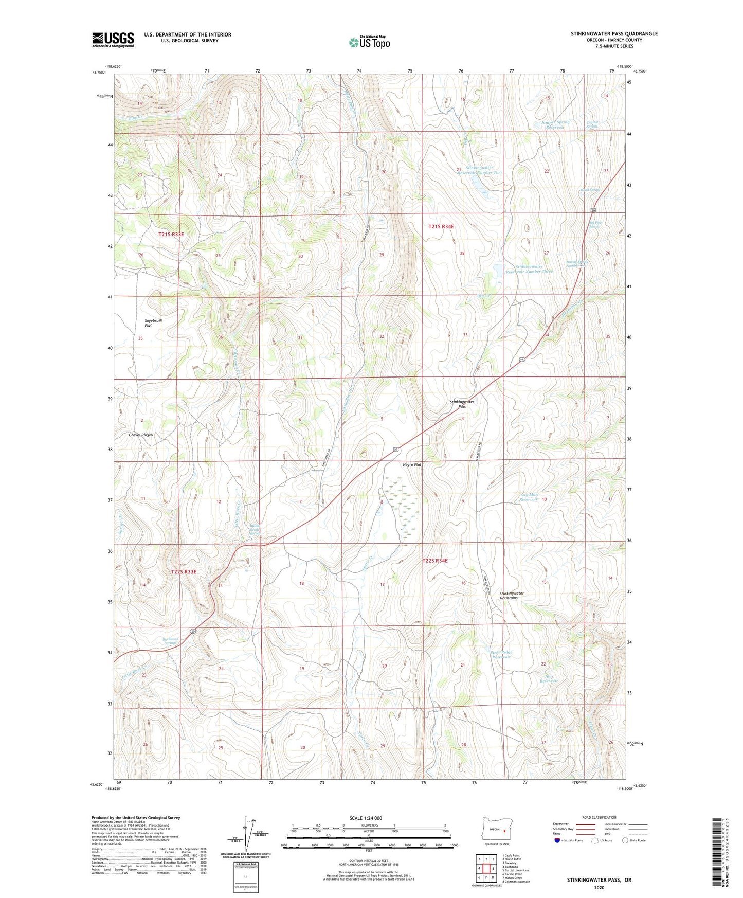
Stinkingwater Pass Oregon US Topo Map
Couldn't load pickup availability
2023 topographic map quadrangle Stinkingwater Pass in the state of Oregon. Scale: 1:24000. Based on the newly updated USGS 7.5' US Topo map series, this map is in the following counties: Harney. The map contains contour data, water features, and other items you are used to seeing on USGS maps, but also has updated roads and other features. This is the next generation of topographic maps. Printed on high-quality waterproof paper with UV fade-resistant inks.
Quads adjacent to this one:
West: Buchanan
Northwest: Craft Point
North: House Butte
Northeast: Drewsey
East: Bartlett Mountain
Southeast: Coleman Mountain
South: Mahon Creek
Southwest: Carson Point
This map covers the same area as the classic USGS quad with code o43118f5.
Contains the following named places: Big Pipe Spring, Buchanan Springs, Buchanan Springs Safety Rest Area, Catterson Creek, Crystal Spring, Drewsey Division, Gravel Ridges, Greenley Gulch, Hiway Spring Number One, Indian Grade Spring, Jims Reservoir, Juniper Spring Reservoir, Lazy Man Reservoir, Negro Flat, Oakley Post Office, Percy West Cabin, Road Spring, Sagebrush Flat, Steer Ridge Reservoir, Stinkingwater Pass, Stinkingwater Reservoir Number Three, Stinkingwater Reservoir Number Two