MyTopo
Bartlett Mountain Oregon US Topo Map
Couldn't load pickup availability
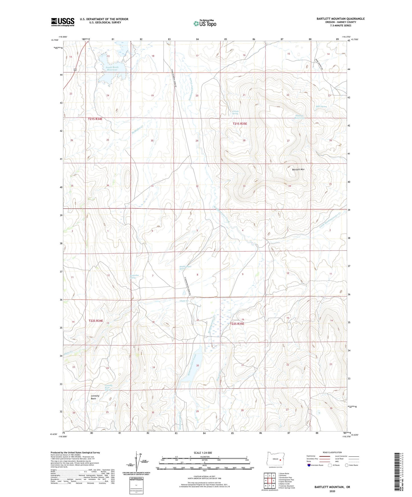
2023 topographic map quadrangle Bartlett Mountain in the state of Oregon. Scale: 1:24000. Based on the newly updated USGS 7.5' US Topo map series, this map is in the following counties: Harney. The map contains contour data, water features, and other items you are used to seeing on USGS maps, but also has updated roads and other features. This is the next generation of topographic maps. Printed on high-quality waterproof paper with UV fade-resistant inks.
Quads adjacent to this one:
West: Stinkingwater Pass
Northwest: House Butte
North: Drewsey
Northeast: Drinkwater Pass
East: Upton Mountain
Southeast: Warm Springs Creek
South: Coleman Mountain
Southwest: Mahon Creek
This map covers the same area as the classic USGS quad with code o43118f4.
Contains the following named places: Bartlett Mountain, Beede North Dam, Beede South Dam, Borderline Spring, Clear Creek, Connolly Basin, Connolly Basin Spring, Lamb Ranch, Little Stinkingwater Creek, McMullen Creek, Miler Spring, Muddy Water Spring, Newell Creek, North Beede Reservoir, O'Toole Ranch, O'Toole Spring, Plateau Reservoir, South Beede Reservoir, Stinkingwater Dam