MyTopo
Warm Springs Creek Oregon US Topo Map
Couldn't load pickup availability
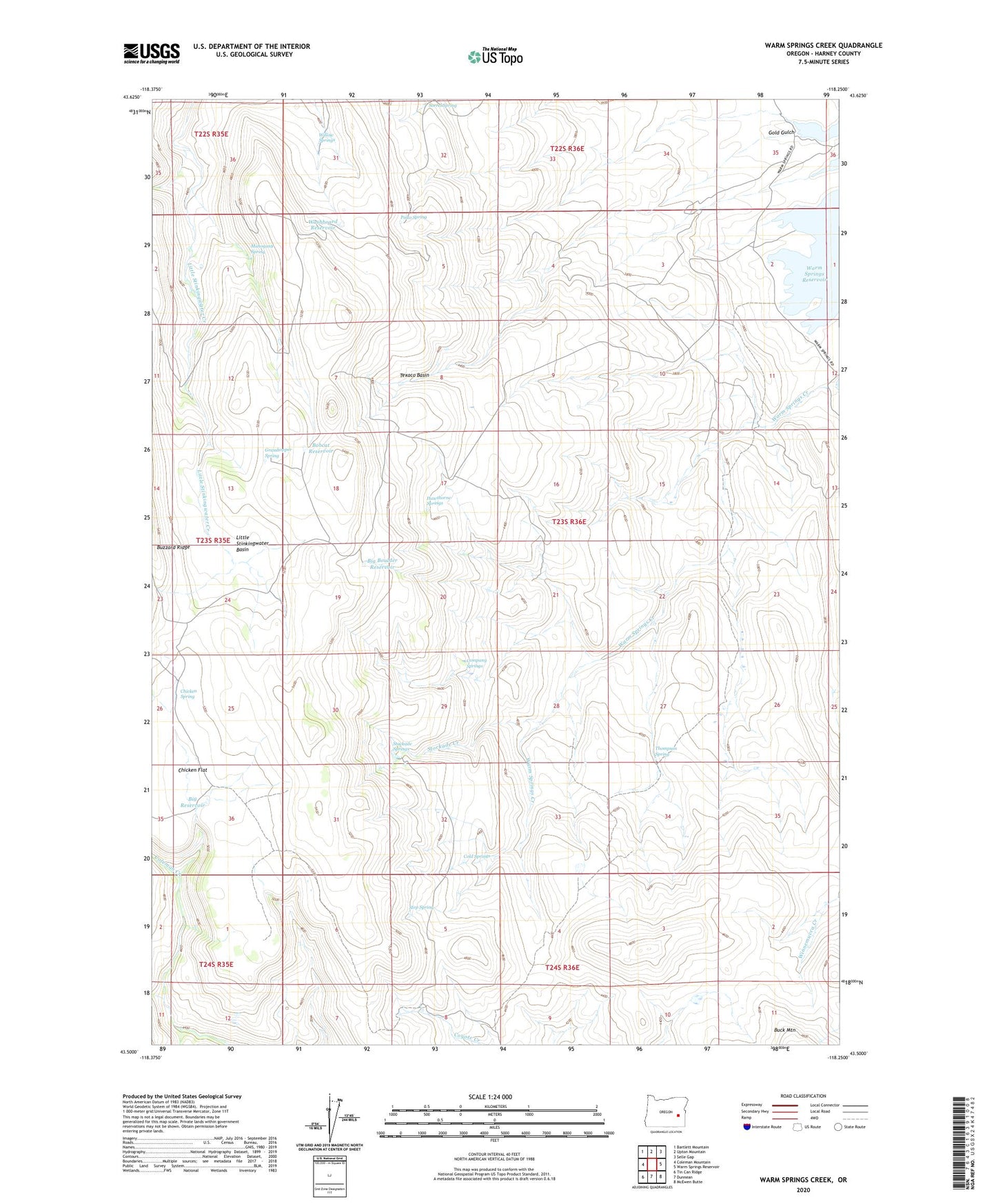
2023 topographic map quadrangle Warm Springs Creek in the state of Oregon. Scale: 1:24000. Based on the newly updated USGS 7.5' US Topo map series, this map is in the following counties: Harney. The map contains contour data, water features, and other items you are used to seeing on USGS maps, but also has updated roads and other features. This is the next generation of topographic maps. Printed on high-quality waterproof paper with UV fade-resistant inks.
Quads adjacent to this one:
West: Coleman Mountain
Northwest: Bartlett Mountain
North: Upton Mountain
Northeast: Selle Gap
East: Warm Springs Reservoir
Southeast: McEwen Butte
South: Dunnean
Southwest: Tin Can Ridge
This map covers the same area as the classic USGS quad with code o43118e3.
Contains the following named places: Big Boulder Reservoir, Big Reservoir, Bobcat Reservoir, Chicken Flat, Chicken Spring, Cold Springs, Company Springs, Gold Gulch, Grasshopper Spring, Hawthorne Springs, Little Stinkingwater Basin, Mahogany Spring, Pinto Spring, Sorrel Spring, Step Spring, Stockade Creek, Stockade Springs, Texaco Basin, The Homestead, Thompson Spring, Warm Springs Creek, Washboard Reservoir, Willow Springs