MyTopo
Coleman Point Oregon US Topo Map
Couldn't load pickup availability
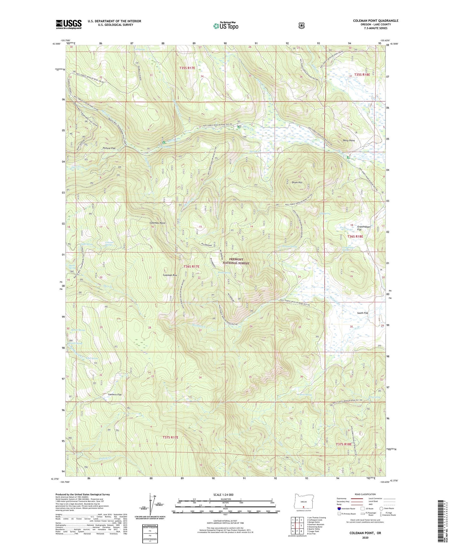
2020 topographic map quadrangle Coleman Point in the state of Oregon. Scale: 1:24000. Based on the newly updated USGS 7.5' US Topo map series, this map is in the following counties: Lake. The map contains contour data, water features, and other items you are used to seeing on USGS maps, but also has updated roads and other features. This is the next generation of topographic maps. Printed on high-quality waterproof paper with UV fade-resistant inks.
Quads adjacent to this one:
West: Gearhart Mountain
Northwest: Lee Thomas Crossing
North: Coffeepot Creek
Northeast: Morgan Butte
East: Shoestring Butte
Southeast: Cox Flat
South: Cougar Peak
Southwest: Quartz Valley
Contains the following named places: Anderson Ranch, Augur Creek, Barrel Spring, Bean Spring, Blonde Spring, Brush Spring, Clear Spring, Clear Spring Recreation Site, Cliff Spring, Coleman Point, Coleman Spring, Colt Spring, Dairy Creek Campground, Dairy Creek Guard Station, Dairy Point, Dairy Point Recreation Site, Dead Horse Creek, Dead Horse Recreation Site, Deer Creek, Drum Hill, Eagle Spring, Grasshopper Flat, Grasshopper Spring, Happy Camp Recreation Site, Lantern Flat, Lantern Flat Guard Station, Morgan Creek, Morgan Spring, Murphy Ranch, North Fork Augur Creek, Picture Flat, Road Spring, Round Spring, Shepard Camp, Snag Spring, South Flat, Spring Creek, Teepee Creek