MyTopo
Lee Thomas Crossing Oregon US Topo Map
Couldn't load pickup availability
Also explore the Lee Thomas Crossing Forest Service Topo of this same quad for updated USFS data
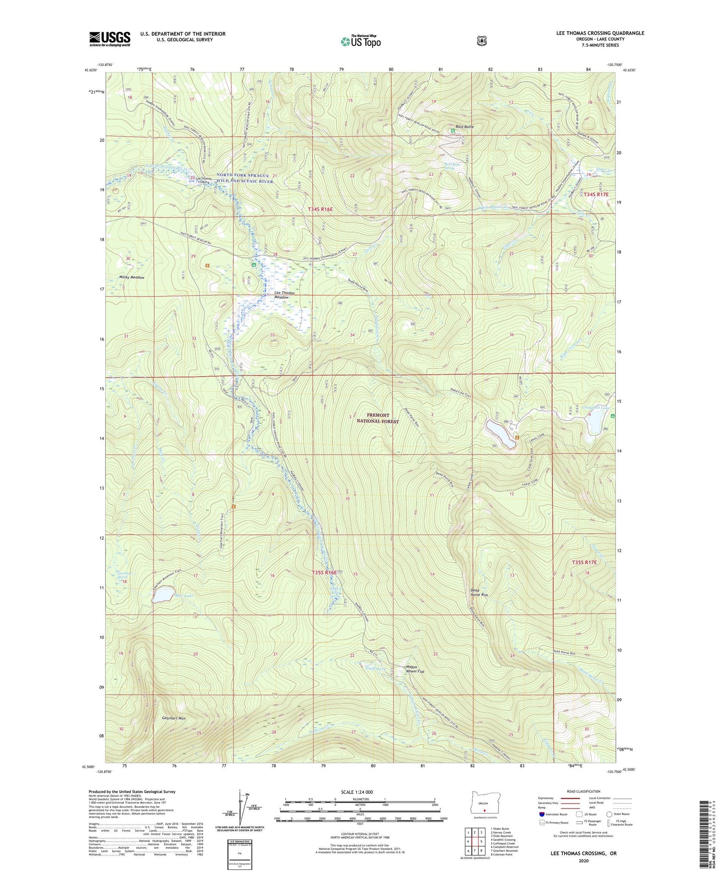
2023 topographic map quadrangle Lee Thomas Crossing in the state of Oregon. Scale: 1:24000. Based on the newly updated USGS 7.5' US Topo map series, this map is in the following counties: Lake. The map contains contour data, water features, and other items you are used to seeing on USGS maps, but also has updated roads and other features. This is the next generation of topographic maps. Printed on high-quality waterproof paper with UV fade-resistant inks.
Quads adjacent to this one:
West: Sandhill Crossing
Northwest: Shake Butte
North: Harvey Creek
Northeast: Slide Mountain
East: Coffeepot Creek
Southeast: Coleman Point
South: Gearhart Mountain
Southwest: Campbell Reservoir
This map covers the same area as the classic USGS quad with code o42120e7.
Contains the following named places: Bald Butte, Bald Butte Lookout, Bald Butte Spring, Blue Lake, Cache Camp, Campbell Lake, Campbell Lake Boat Ramp, Campbell Lake Recreation Site, Dairy Creek Campground, Dead Cow Creek, Dead Horse Lake, Dead Horse Lake Recreation Site, Dead Horse Rim, Deadhorse Lake Campground Boat Ramp, Frigid Spring, Gearhart Marsh, Gearhart Mountain Wilderness, Gold Creek, Head of River Spring, Hole Creek, Ingram Guard Station, Lakes Loop Trailhead, Lee Thomas Crossing, Lee Thomas Meadow, Lee Thomas Recreation Site, Mulky Meadow, North Creek, North Creek Campground, North Fork Sprague River Trailhead, North Fork Sprague Wild and Scenic River, Nottin Creek, Pole Creek, School Creek, Wagon Wheel Creek, Wagon Wheel Flat, Walker Creek, White Horse Creek