MyTopo
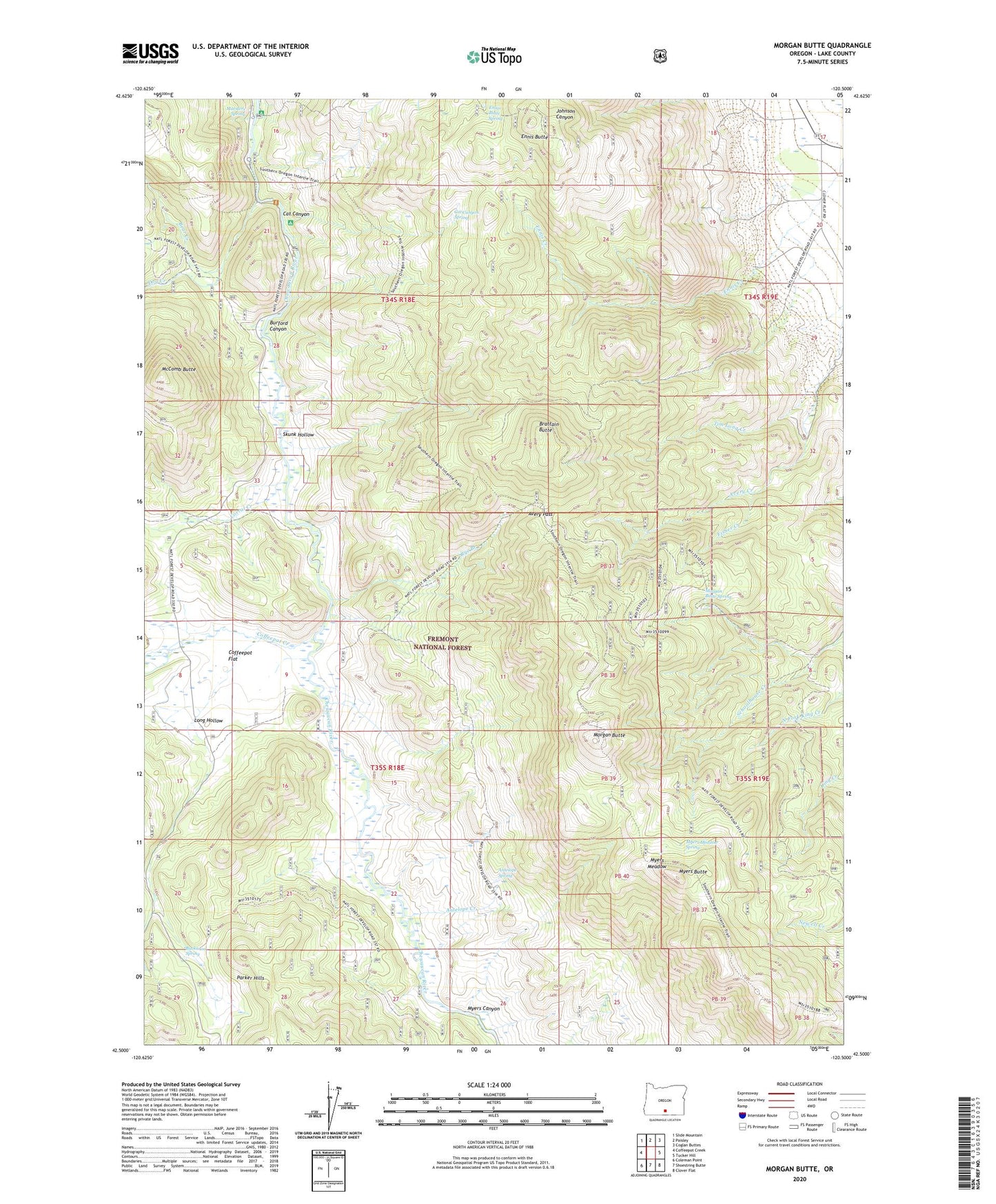
Morgan Butte Oregon US Topo Map
Couldn't load pickup availability
Also explore the Morgan Butte Forest Service Topo of this same quad for updated USFS data
2023 topographic map quadrangle Morgan Butte in the state of Oregon. Scale: 1:24000. Based on the newly updated USGS 7.5' US Topo map series, this map is in the following counties: Lake. The map contains contour data, water features, and other items you are used to seeing on USGS maps, but also has updated roads and other features. This is the next generation of topographic maps. Printed on high-quality waterproof paper with UV fade-resistant inks.
Quads adjacent to this one:
West: Coffeepot Creek
Northwest: Slide Mountain
North: Paisley
Northeast: Coglan Buttes
East: Tucker Hill
Southeast: Clover Flat
South: Shoestring Butte
Southwest: Coleman Point
This map covers the same area as the classic USGS quad with code o42120e5.
Contains the following named places: Antelope Creek, Antelope Spring, Avery Creek, Avery Pass, Bear Creek, Brattain Butte, Buckaroo Spring, Burford Canyon, Cat Canyon, Cat Canyon Spring, Chewaucan Crossing Trailhead, Coffeepot Creek, Coffeepot Flat, Corral Creek, Dog Creek, Ennis Butte, Ennis Butte Spring, Fisher Creek, Jones Crossing Recreation Site, Jones Trail, Long Hollow, Marsters Spring, Marsters Spring Recreation Site, McComb Butte, Morgan Butte, Morgan Butte Lookout, Morgan Butte Spring, Myers Butte, Myers Canyon, Myers Meadow, Myers Meadow Spring, Rye Branch, Skunk Hollow, Upper Jones Recreation Site, Upper Marsters Spring Recreation Site, Whitehouse Place, ZIP Code: 97636